Back in March, the LRC predicted the 1st week of August to be an active one and this is panning out to be an active week with the worst storms appearing to land just to our south in SD.
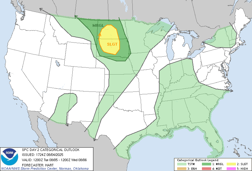
There’s a slight risk for severe weather on Tuesday for much of Western/Central ND and SD:
As those storms develop in the afternoon in western ND, they will ride east into the Valley toward sunset and into the overnight hours. Wed/Thur. look quiet with warmer and humid temps coming into the area.
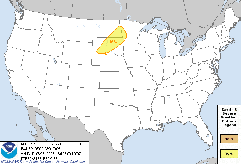
Thursday night and Friday night storms are expected to roll in from the west and some of those may be severe as well:
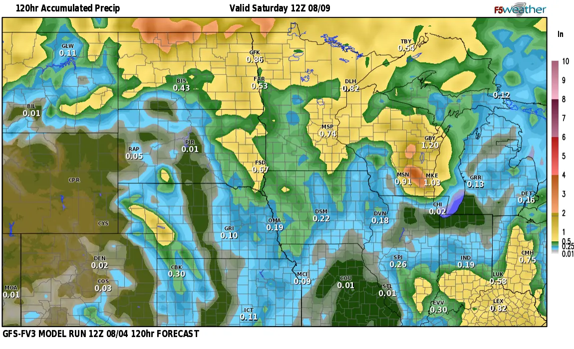
After the storms roll through, cooler and less humid weather for the weekend. How much rain? It all depends on IF the storms out west hold together into the Valley. Assuming they do, this may be our expected rainfall through Saturday:
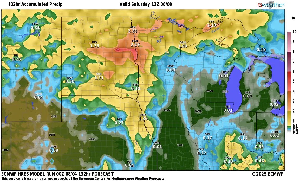
If the storms DON’T hold together, amounts will be significantly less…..