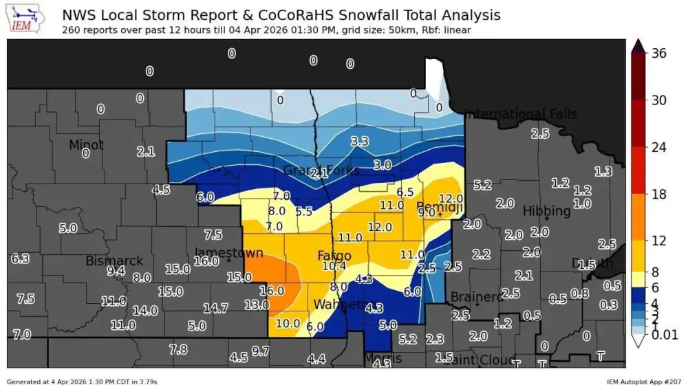
Severe weather hit the N. Valley hard early this morning with 90+ mph winds and damage in the Grand Forks area. Here’s a look at statewide severe weather reports:
90+ mph winds in Grand Forks produced some pretty nasty damage:
Courtesy: Lindsey Gerszewski
Pretty scary stuff for sure!! Now we focus our attention this evening into tonight where another round of severe weather is possible. Latest model runs are shifting the severe weather to our east into Lakes country this evening between 7pm and midnight:
The timing on these storms looks to be from 7pm through midnight. I’m not TOTALLY sold on all the severe weather being east of the Valley but it’s a good sign. This could pose a problem for WEFest around the 9pm to midnight time frame. Although, there is a 30% chance that the severe storms stay just south of DL. The weekend looks much quieter with breezy conditions with a spotty shower possible from 94 corridor northward Saturday afternoon. Temps over the weekend will top out around 80.