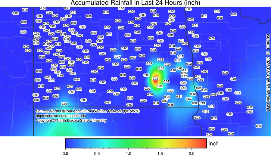
Summer heat and humidity popped off some isolated storms yesterday evening just to the west of the F/M area. Here’s a look at some of the rainfall totals with the heaviest rainfall going to Ypsilanti at 2.35″
Now, we haven’t had any “heat waves” this summer. The longest stretch was 4 days of 90 degree heat all the way back in MAY!!! However, the summer as a whole has seen above normal temps with above normal precip. Now we are starting to see signs of fall on our weather maps. Not in the short term, however. Summer like heat will be with us through Thursday. Afterwards, a cool airmass from Canada pushes into the area with cool 60s/70s with night time lows in the upper 40s for the upcoming weekend. Outside of our storm chance on Thursday, the next week to 10 days looks pretty dry.