What a fall we’ve had with temps well above normal. Get out and enjoy the weekend because much colder weather is on the way next week. The weekend looks beautiful with temps in the low 50s!! A storm system will be pulling in from the west on Tuesday into Wednesday. This will bring some light rain showers Monday night into early Tuesday before strong winds on the back side of the storm drag in colder weather from the north. Winds will be strong Tuesday night into Wednesday:
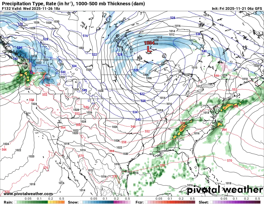
This is a snapshot of Wednesday afternoon indicating WINDY conditions along with some snow showers. I’m not expecting much snow with this 1st storm:
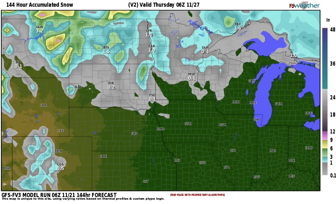
This is ONE forecast for snow amounts Tuesday into Wednesday. As you can see, not much. 1/2″ to 1″ across the area.
Thanksgiving looks quiet with sunshine and temps in the 20s. After Thanksgiving, things get tricky. A clipper system looks to be pushing through the area on Friday. It will deposit a swath of snow, mostly to our west:
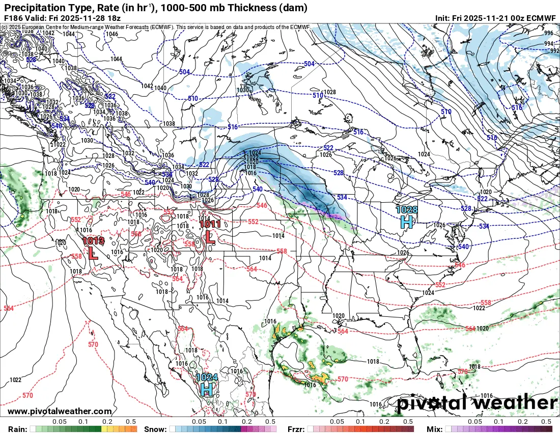
Friday’s clipper could drop 1-2″ across the area with lighter snow in the N. Valley. I don’t think the 10″ will be realized in BIS, however, measurable snow along with slippery travel is likely for Friday.
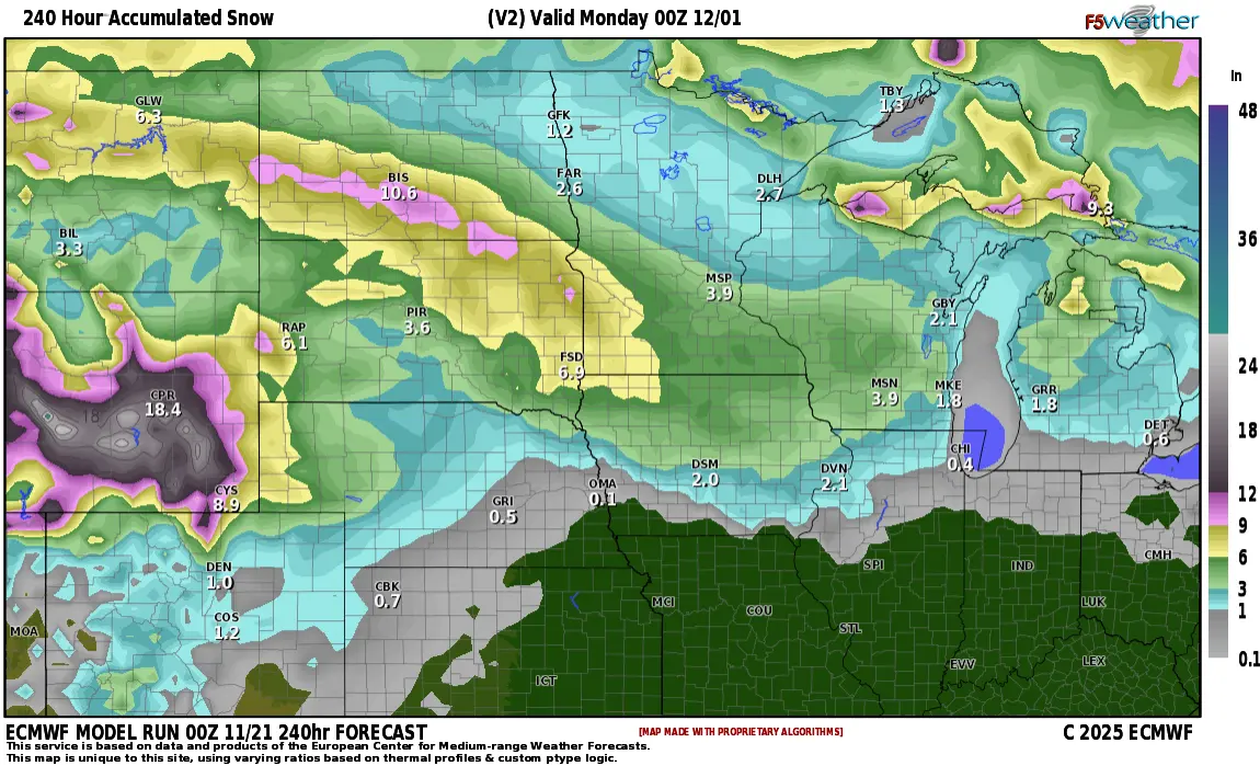
After Friday’s clipper system, our attention turns to the POTENTIAL for a larger system next Sunday/Monday. Models this far out are all over the place with anywhere from 2-20″ so I will hold off on predicting any amounts with the Sunday/Monday storm. I am leaning toward it being a more significant storm though due to the fact that it lines up very well with the LRC wet period from Oct. 10th – 17th across the state. Stay tuned and if you have any travel plans POST Thanksgiving, please keep up to date on the forecast.