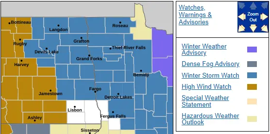
WINTER STORM WATCH is in effect for much of the area. I am expecting parts of the area to be upgraded to a Winter Storm Warning sometime later today or tonight. We have a “weak” clipper system that will be moving through the area today with 1/2″ to 1″ of snow expected by evening. Slippery travel is expected for your evening commute. Tonight, we will see a lull in the snow with just a few flurries expected.
Tuesday, a stronger clipper system will be riding in from the NW. The early AM commute should be tolerable BUT the afternoon and evening commute is going to be a MESS! Snow will overspread the area by mid morning and become heavy at times as we head into the afternoon. Winds will increase significantly in the afternoon/evening as they gust over 30mph out of the north producing very poor visibility with near blizzard conditions possible especially in open areas and to the north of the F/M area.
Here’s the latest snowfall predictions:
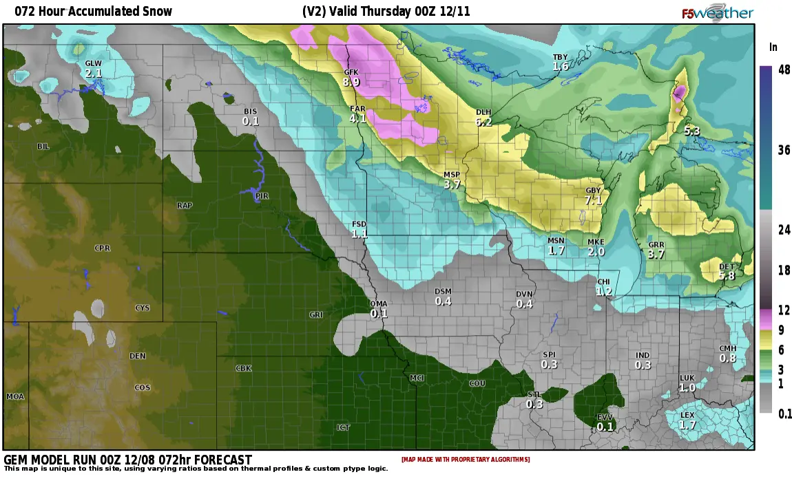
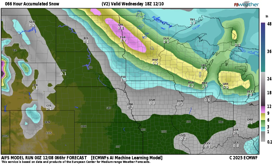
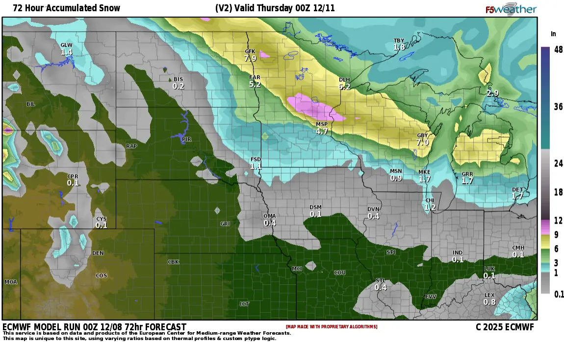
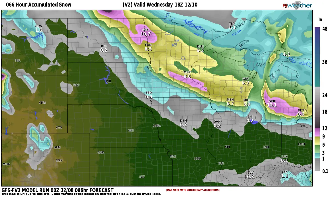
Most models are focusing on 3-6″ range with up to 8″ possible. Again, Tuesday afternoon and evening commute is going to be a MESS….travel not recommended during the afternoon/evening.