After a spill of Arctic air Friday and Saturday of this week, we have a quick warmup on the way for early next week. This has been the theme this month with the LRC. Anytime we get a shot of “arctic” air, it’s been brief. Expect that to continue through the winter. Although we WILL see our snow pile up this winter, the temps on average should be above normal.
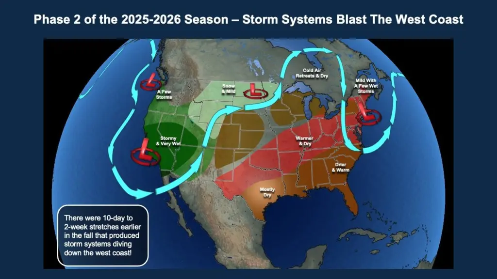
After 4-5″ of snow across the F/M area with this last storm (Grand Forks had 11″) we are now about to enter “phase 2” of the LRC. This is what I like to call the “wild card” phase of the LRC. This is the part where the west coast gets hit with rain/snow and this is the part of the pattern that produces those BIG Colorado lows:

This won’t ALWAYS produce snow for us as some of the storms will pass south or west of the area BUT I want you to take a look at what the LRC is predicting right around Christmas time:
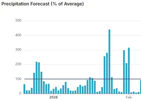
This is a precipitation chart of when we will see above average precip. Notice the “spike” in precip (snow) right around Christmas where we have 200% above normal precip. This indicates a good chance for a larger “snow event” around the 23-25th of December before things mellow out around the New Year.