We’ve been lucky so far this January with mild temps and little snow to worry about. Now, the second half of the month looks completely different as much colder air is going to be pushing in from Canada.
A strong clipper system will be ushering in the cold and WINDY weather on Friday with snow showers. I’m not expecting a LOT of snow (1-2″) but even with that amount, when you factor in 40+mph wind gusts, travel will be difficult on Friday with blowing snow and reduced visibility. We will have some areas that have near blizzard conditions.
Advisories will be issued by the NWS (National Weather Service) for Friday but not sure we will reach blizzard criteria. What IS the criteria for a Blizzard Warning? You have to have less than 1/4″ visibility with snow or blowing snow for 3+ hours along with 35+mph wind gusts. I do believe we will see periods of visibility less than 1/4 mile throughout the day but not quite sure it will be for the 3hr or more criteria. Regardless, travel will be DIFFICULT on Friday from mid morning through evening as that would be the time frame for the peak snowfall along with strong winds.
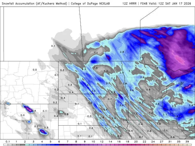
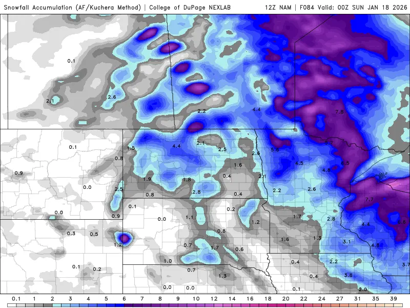
Here is a look at a few of our short term models prediction of snowfall for tomorrow. Notice the “banding” of the snow, meaning, there will be a few narrow bands of “heavier” snowfall while 30 miles either side of the banding, much lighter amounts will occur. It’s nearly impossible to be able to tell where the banding will occur until the event unfolds tomorrow morning/afternoon.
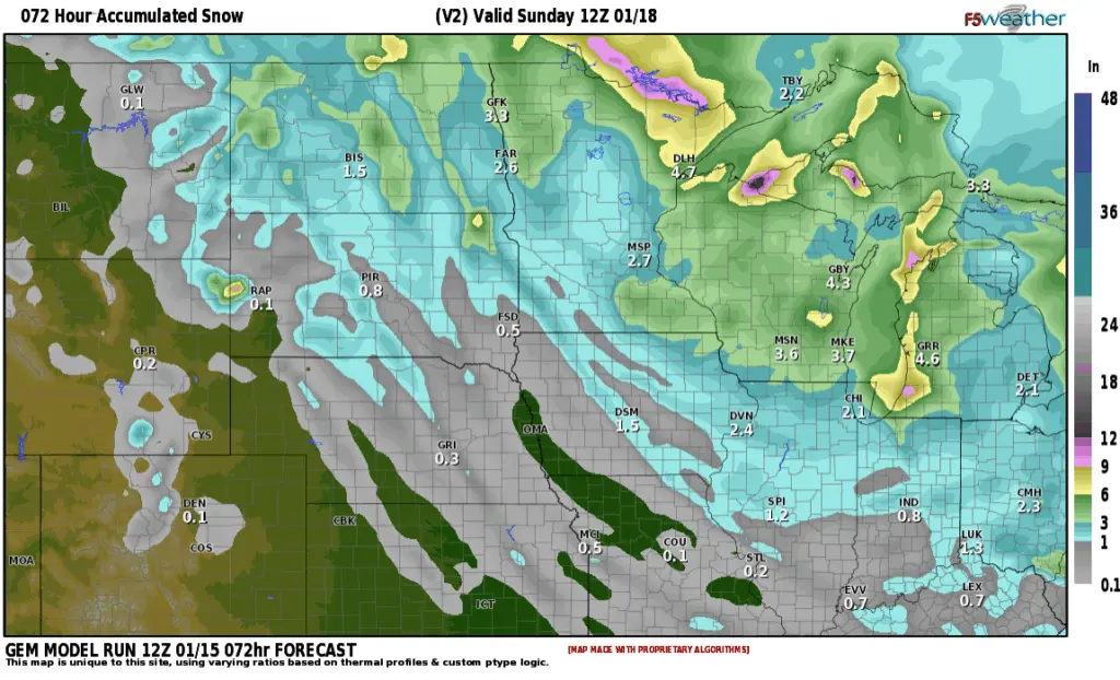
Prepare for tricky travel on Friday. Another clipper system will bring us some more light snow on Sunday on the order of 1/2″ to 1″ with cold weather sticking around through then end of the month.