Near record warmth today!! Record high is 43 set back in 1935. I do believe we will be flirting with that today with temps in the low 40s. Our nice mild spring weather will continue through Monday with temps WELL above normal (normal high is in the low 20s) However, it IS still February and all good things must come to an end.
We start to turn our attention to next week. We have 2 storms systems to watch. The first one comes in Tuesday/Wednesday of next week with rain changing to snow. This one is showing up a bit stronger on our latest model runs with some parts of the state picking up significant snow. The million dollar question is WHERE and how MUCH??? With the storm being 5-6 days away, there will be changes in regards to the amount of snow that is expected.
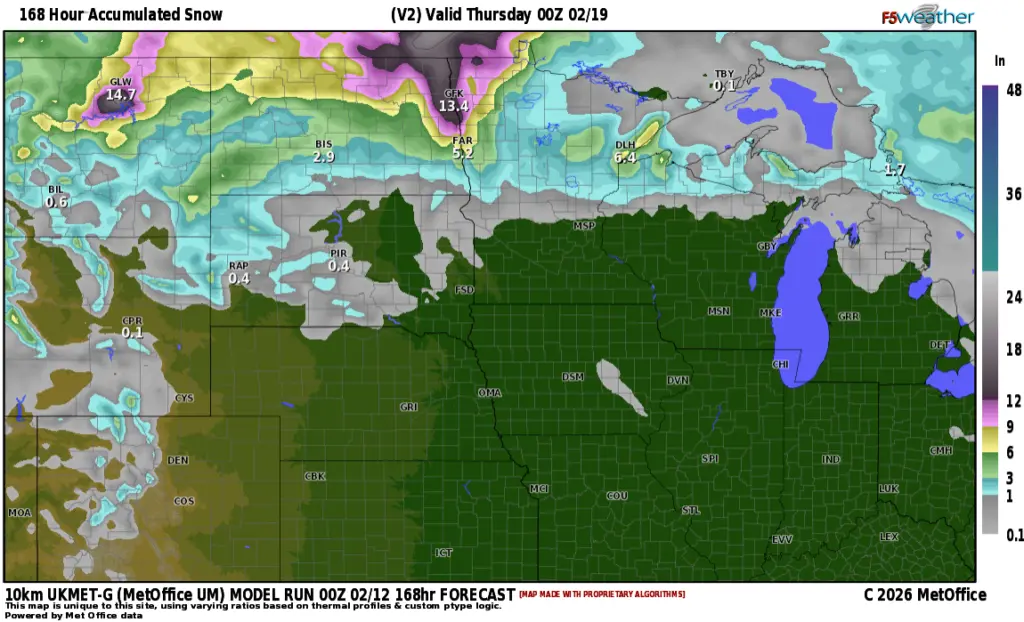
First, lets take a look at one of our AI models which to me looks a bit EXTREME in regards to snowfall amounts. Here’s the European AI model’s forecast for Tue/Wed. snow system:
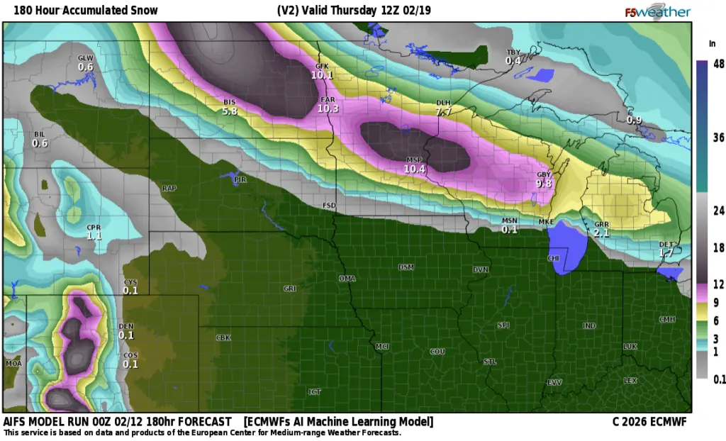
Now, CMON!! 10-14″ across our area?? The chances of this much snow stands at about 20%
Let’s look at some more realistic expectations for Tue/Wed. snow:
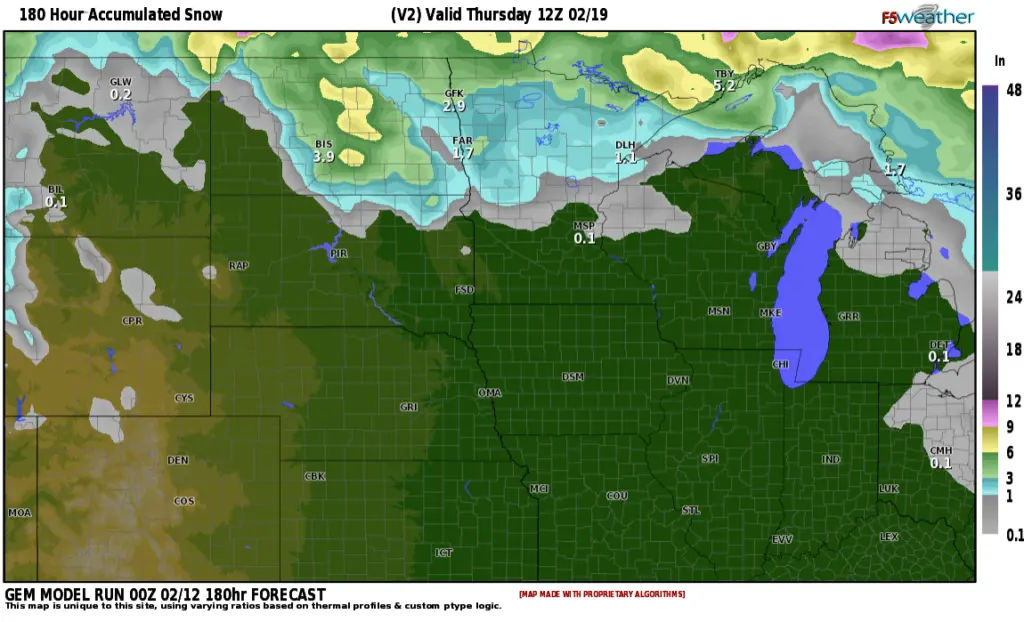
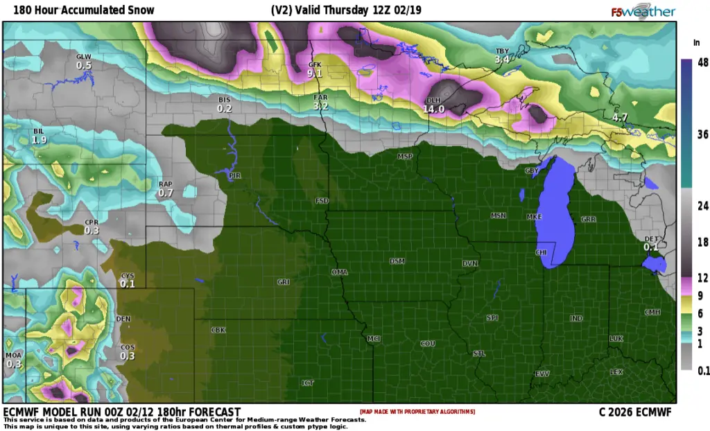
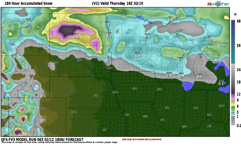
Most of the other models are keeping the heavier snow into north central ND into NE North Dakota/NW Minnesota with only a few inches in the F/M area. If we can get enough cold air wrapped into the F/M area we COULD get some heavier amounts into F/M area into lakes country. After the Tue/Wed. storm system, there is another potential storm for the following weekend. Stay tuned…..