After a RECORD SETTING weekend with temps across the state in the 60s and 70s, this week is a slap back to reality with more “normal” temps expected. Temps most of this week should be in the 30s with a few storm systems pushing across the region.
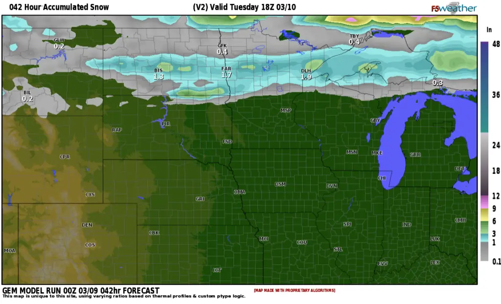
Storm #1 is expected to produce some light snow (around 1-1.5″) along the I-94 corridor tonight:
Storm #2 will bring wind and a rain/snow mix on Thursday, however, I’m not expecting much if any accumulation out of that storm as temps will be around 40 so it shouldn’t be a problem in regards to travel.
Storm #3 arrives over the weekend and has the POTENTIAL of producing snow and wind:
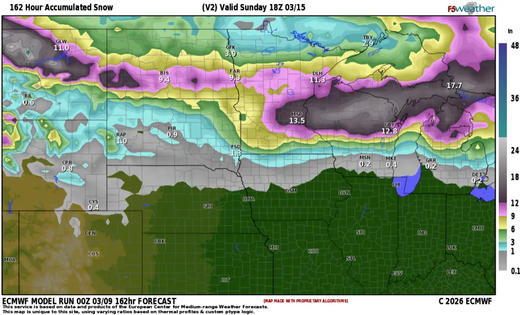
This storm is still out in the Pacific, so many things can change between now and the weekend. The timing of the weekend storm looks to be Saturday into early Sunday. Stay tuned……