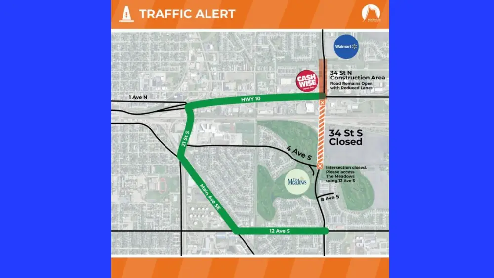
MOORHEAD, Minn. – A construction zone in Moorhead that initially failed to appear on Google Maps for driver awareness is now up on the app.
The change was made after Flag Family News reached out to the city about why the zone was not appearing near Moorhead Cash Wise and The Meadows.
According to a city spokesperson, Moorhead doesn’t have a way to contact Google or adjust their maps other than reporting the closure, which can be done by anyone.
The city says nothing can be done about the issue until Google joins the city’s Geographic Information System.
The GIS uses data attached to a unique location according to the United States Geological Survey.
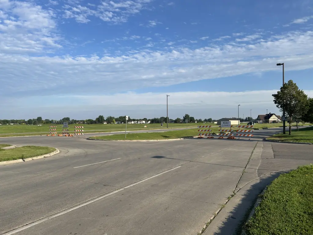
Reporter Austin Erickson asked the city about the issue after using Google Maps to try and maneuver around the construction zone near The Meadows Golf Course.
Erickson also saw semis doing U-turns near the closure at 34th Street and 8th Avenue South.
The construction is part of the City of Moorhead’s five-year plan which includes the replacement of the 34th St. bridge approach panels.
Work on 34th St. from Center Avenue/Highway 10 to Fourth Avenue South is expected to be finished by the middle of the fall.
Work on 34th St. from Center Ave./Hwy. 10 to Third Avenue North between Cash Wise and the Dilworth Walmart includes lane reductions. That portion of the project is set to be finished by late fall.
Click here for more information on the project.