Mon, Apr 26th, 2021 - 6:55am
June 10, 2021 - 11:10am | By Dean Wysocki

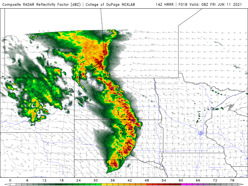
Here we go again!! Another round of severe weather after today's heat and humidity! Today should be relatively quiet with muggy conditions and highs in the mid 90s. There is a slight chance for a few afternoon storms to develop in the south valley. After dark, a line of storms will develop in the western part of the state. These will be BIG hail producers for the western Dakota's As this line moves east it will start to "bow" out as you can see on our future radar map. Whenever you see a line of storms start to "bow" this is indicative of very high winds. We could have 70+ mph winds in the central Dakota's around 3am. As this line approaches the valley, the storms should be in a weakening phase but severe weather may still be possible. Timing on the storms reaching the valley would be between 4 and 6am. WDAY and the FLAG will have live coverage as the storms approach.
After the storms blow through, the weekend looks great. Lower humidity and temps in the 80s to low 90s.
Chief Meteorologist
Dean Wysocki