


Sun, May 23rd, 2021 - 10:34am
September 18, 2021 - 3:48pm | By Justin Storm
Summer-like heat will push into the valley for Sunday, with the warmth will come a chance for some scattered showers in the afternoon, a chance for storms in the late afternoon/early evening, and storms overnight Sunday as a cold front travels across North Dakota. After the passage of the front, cooler weather will be around through mid-week... but how long will it stick around?
It has been quite a breezy day today, to say the least, at least it's been pleasantly warm out. Winds will continue to come from the south through the remainder of our day, overnight, and throughout the day of Sunday between 15-30 mph. I hope everyone was able to enjoy this breezy but nice day outside! We have one more day of heat coming tomorrow for Sunday (9/19/21) but, I can't say it will be as nice as today (Saturday 9/18/21).
Tonight, and Sunday
Tonight will be a perfect night to leave some windows cracked to catch a pleasant breeze throughout the house! It will remain breezy, but temperatures will remain quite pleasant. Overnight temperatures will be holding in the mid to upper 60's across the area with mostly clear to partly cloudy skies!
Clouds will be on the increase throughout Sunday but will still catch some sun here and there. Mostly in the morning hours then spotty sun in the afternoon. Depending on when these clouds push in will greatly affect our highs across the region tomorrow. If the clouds roll in early will be stuck in the mid 80's but if they hold off into the mid-afternoon will catch highs in the upper 80's. Some spots may even flirt with 90! I'm forecasting a high of 86 degrees in Fargo tomorrow with a slight chance for a couple of isolated afternoon showers.
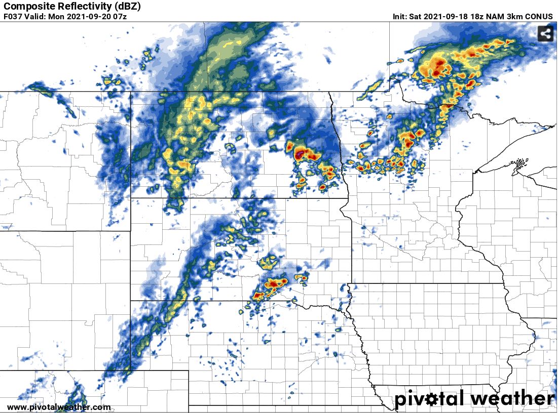
Sunday early evening into Monday; Storms... Severe Storms?
Looking into the evening hours of Sunday we may have a few thundershowers develop ahead of an advancing cold front within the warm sector of low pressure. Let us say after 6:00 PM we may see a few thunderstorms developed within the southern valley. One or two of these storms could be on the strong to severe side but are contingent on a few variables playing out, that remain uncertain at this time (will have more certainty tomorrow).
I'm keeping my attention on the overnight hours as the cold front barrels across the Red River Valley. This looks to be after midnight but the timing on this may change an hour or 2 in either direction as well as for the late afternoon/early evening storms. This is mainly because the fronts are expected to stall through the day, then pick up momentum later on. As the cold front pushes eastward more storms and thundershowers will develop along it and a couple may be strong to severe overnight.
The main concern would be damaging wind and hail. Any storms that fall behind the front will likely be elevated storms and lose their severe possibility rather quickly.
The overall severe risk doesn't look to be high but it is possible for a couple of storms to be severe.
Monday through Wednesday
After the passage of the cold front, cooler weather will stick around for Monday. We will hit our high temperature before the sun even rises on Monday, and have temperatures in the 50's in the afternoon. If we're lucky will be able to top out in the low to mid-60's but id say mid to upper 50's close to 60 is the more realistic bet. Monday will be breezy as well with NW winds between 10-20 G30 but "calming" winds into the later afternoon and evening. There will also likely be some leftover showers in the morning then a slight chance for a few showers in the late afternoon and evening hours.
Tuesday and Wednesday look nicer with mostly sunny to partly cloudy skies and temperatures in the mid 60's on Tuesday and low 70's for Wednesday. Enjoy these "cooler" but nice days!
End of the week and weekend
Temperatures look to be sticking around in the 60's to low 70's through the coming weekend with a chance for more warmth coming at the end of the weekend. Rain doesn't look likely.
Meteorologist,
Justin Storm


