


Mon, Dec 13th, 2021 - 8:45am
October 13, 2021 - 10:56am | By Dean Wysocki
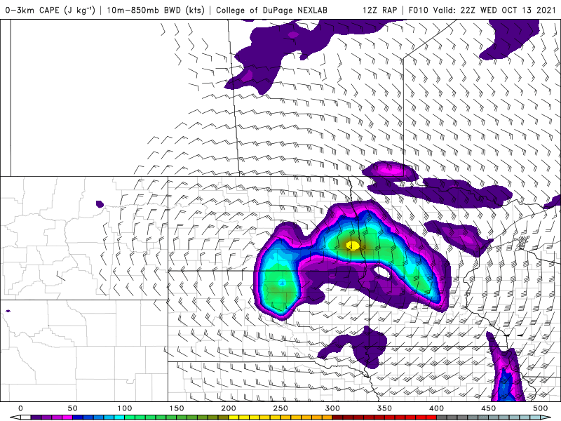
The map shown is instability at approx 5pm today. Notice the "bullseye" right around the F/M area. As this storm lifts north, there is a possibility of isolated tornadoes this afternoon between 4pm and 7pm. There is a LOT of "spin" in the atmosphere to aid in possible tornado development. It's a somewhat similar set up that brought the tornado to Park Rapids the other day. This is a dynamic storm with snow on it's western side and severe weather on it's eastern side. A foot or more of snow today from the Black hills into Montana. while heavy rains blanket parts of ND. Expect 1/2" to 3/4" of rain in the F/M area. After this storm lifts north tonight, windy and cooler weather will follow for the rest of the work week. Our first FROST is possible Saturday morning but temps over the weekend will rebound into the 60s with plenty of sunshine.
Chief Meteorologist,
Dean Wysocki


