Tue, Feb 15th, 2022 - 11:19am
May 11, 2022 - 8:18am | By Dean Wysocki

The wet weather pattern continues as storm systems continue to line up and impact the northern plains. This has been preventing many of you from getting out into the field.
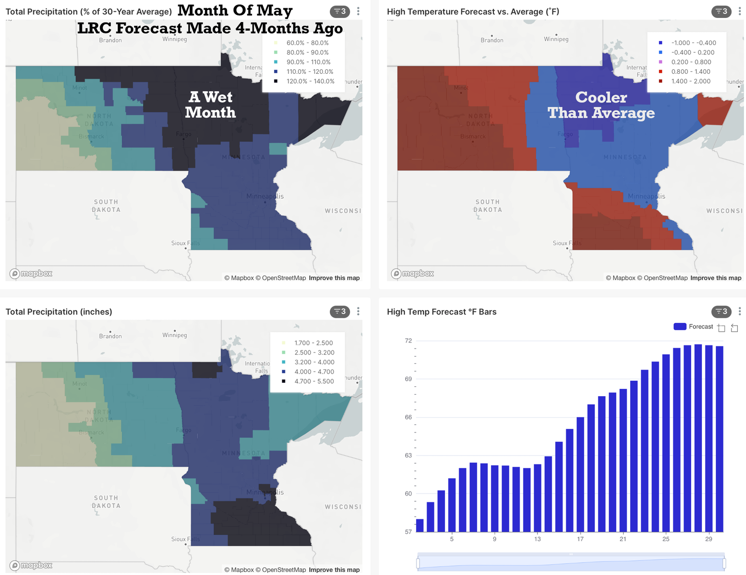
This first map shows the % of average rainfall from April 10th to May 10th. The wettest region continues to be centered on North Dakota. There have been a few other wet areas across the west coast from central, CA north into Washington, and also over the Ozark’s in Missouri extending south into Oklahoma.
The weather pattern is cycling according to the LRC. If you are new to this breakthrough technology, it provides us the effective-accurate-different weather data based on the cycling weather pattern. The LRC sets up each fall in October and November and this pattern set up into a ~64-day-cycle, or around 9-weeks long.
We are currently in the fourth cycle of this year’s weather pattern. Take a look at this forecast for May made by the patent-pending LRC model. This is a forecast based on the LRC for the month of May over the northern plains, which now matches what has been happening and what is in progress as we approach the middle of the month.
The drought conditions continue out west with fires continuing to burn up New Mexico. The Texas/New Mexico border just had some wet thunderstorms yesterday, but most of that state continues to be dry.
For North Dakota & Minnesota the relentless storm systems are not going to stop. This is now starting to produce set-ups for severe thunderstorms with hail, wind, and tornado risks as well.
In the next few weeks, the jet stream will be retreating north. The jet stream is caused by temperature contrast and as summer approaches and Canada continues to warm-up, the jet stream will weaken and shift north. The storm systems will eventually get weaker, but even during the summer, these weaker storm systems will still track across the region continuing the above average rainfall into summer.
As fall approaches, this same 2021-2022 cycling weather pattern will intensify in September, and then the pattern will finally begin changing in late September as the new LRC sets up.
There will be some dry periods, just not many of them across that extremely wet region of North Dakota and Minnesota. We are continuing our analysis and will provide some insights into which weeks will be wet and which will be dry.
May will continue to be WET but I am seeing a few "windows" of drier weather....one of those from this Friday through next Tuesday/Wednesday (only a light shower fri night/Sat am) Afterwards, another WET storm system will arrive the following weekend.
Chief Meteorologist,
Dean Wysocki