


Wed, Jan 26th, 2022 - 1:55pm
November 17, 2022 - 11:10am | By Justin Storm
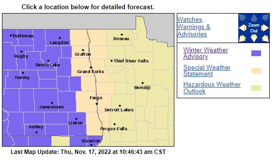
A Winter weather advisory is in effect west of the RRV today until midnight but blowing snow is still possible through Friday with some scattered flurries and light snow showers.
Visibility around the RRV ranges from .25-4 miles due to windy conditions gusting as high as 40 mph today, mainly 15-30 NW, within the RRV and Lakes Country with scattered flurries and light snow. Temperatures will slowly fall into the teens through today into the lower single digits tonight with wind chills subzero and windy conditions presenting! It will, unfortunately, remain blustery on Friday with a SW wind of 15-30 mph and some scattered flurries/light snow showers, leading to more patchy blowing snow and some slick roads. High temperatures on Friday are capped in the mid-teens with sub-zero wind chills. Flurries taper off overnight Friday into Saturday morning and wind will decrease between 10-20 mph later in the afternoon of Saturday with highs again in the mid-teens.
I do see a subtle warm-up into next weeks with high temperatures in the 20's to lower 30s possibly. It will come with a chance for some snow overnight Monday in the northern valley. Additionally, I see a potential clipper system heading our way on Thursday for Thanksgiving, too far out to really have a good idea of what will play out, but something to keep in mind if you have traveling plans.
A general inch is what I expect to fall around the area but a light dusting to about 2 inches looks possible up and down the valley through Friday night.
Meteorologist,
Justin Storm


