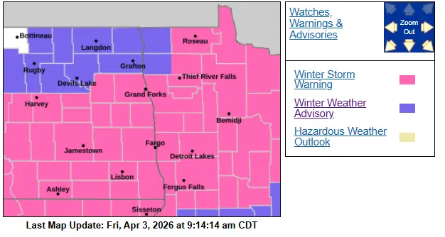
There is a lot of snow pack around the area that will be melting off rather quickly throughout the next couple of weeks. Temperatures are expected to rise into the 40s and 50s over the weekend and next week, and a chance for some rain towards the end of the coming week. Although individual flood forecasts for individual rivers are not out, the National Weather Service of Grand Forks is expecting moderate to major flooding around the area this spring. A few variables that will play a role in this still remain unclear and will take several more days to exactly be able to determine where rivers will crest. This includes exactly how warm for how long we remain ‘warm’. How much additional rain and or snow will we see through the next couple of weeks, and of course ice dams?
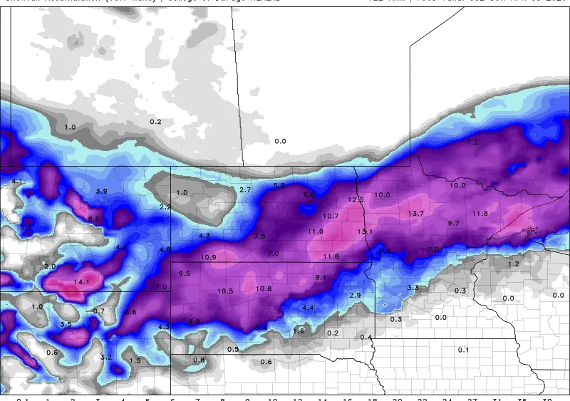
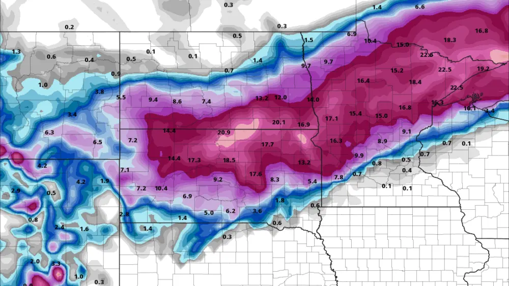
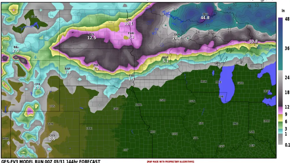
We do have a few things going for us though. Frost levels are very shallow, soil temperatures from the surface to four inches deep are 29-33 degrees, and we went into last fall dry. Meaning that a lot of moisture will be able to be absorbed into the soils, and not sit on top of a deep thick frost layer, then run off into river systems. ( see several images below )
Stay tuned as we will continue to give updates on flood potential, and it is inevitable… I mean it floods every year, it’s just how much does it flood is something we will monitor very closely.
Meteorologist,
Justin Storm