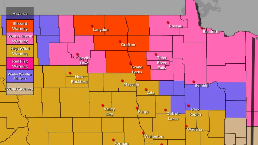
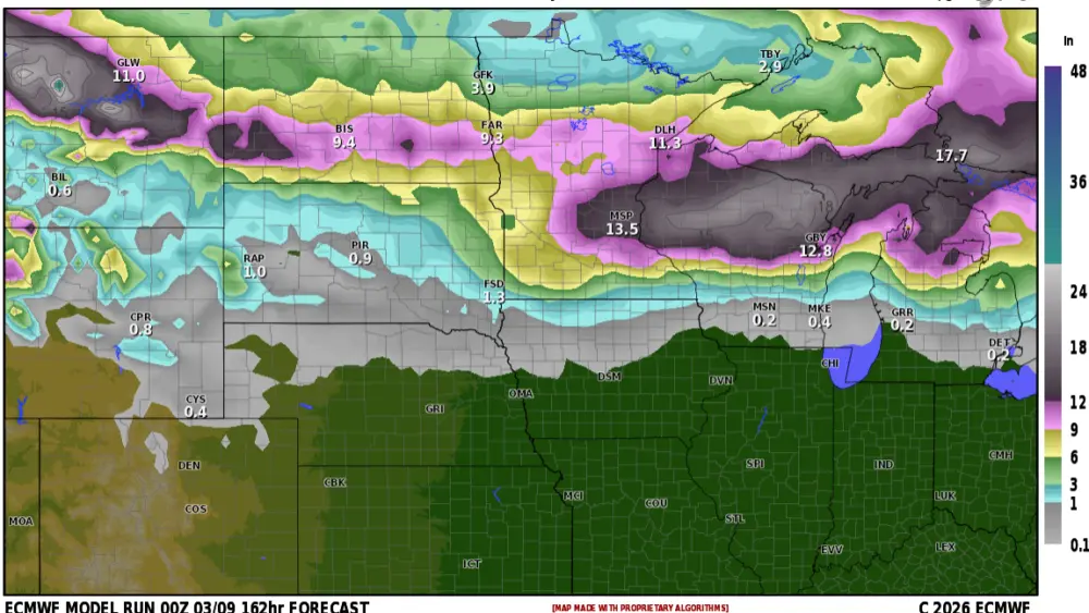
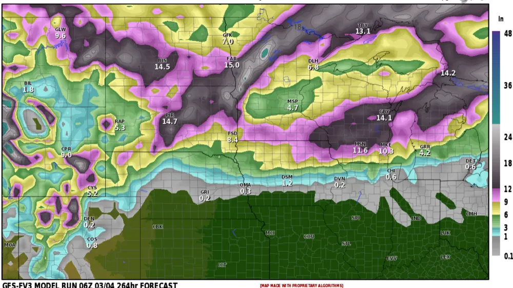
It was a record warm Labor Day weekend with temps topping out in the mid to upper 90s!!! What a great end to summer, or is it? ALL long range models are signaling and END to the 90 degree temps in our area for the rest of the season. As we transitioned to the cooler weather today, some pretty impressive rainfall totals stretched from Bismarck to Grand Forks with 1-3″ common while in the F/M area, less than .10″ This week will bring in much cooler weather with temps remaining mainly in the 70s. As we head toward mid month, there are strong signals for a much cooler air mass to slide in from Canada from the 16th through the 20th. This could potentially bring with it some areas of frost. It will definitely start feeling and looking like fall in the near future.
Chief Meteorologist,
Dean Wysocki