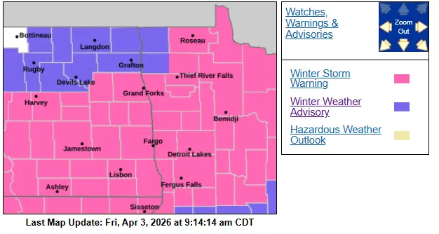
A winter weather advisory is in effect until 3:00 pm although it is possible areas may see that extended later into the afternoon. A light freezing drizzle and fog are creating some icy roads out there. A wintery mix will continue through the morning hours into the afternoon but slowly turn over to light snow and become more widespread through this evening as well as tonight. Roads will likely remain icy in spots across North Dakota. ( See Latest North Dakota and Minnesota road reports here: North Dakota —- Minnesota)
Temperatures will warm near to slightly above freezing today in the Southern Valley and portions of Minnesota, so expect some improvements in road conditions but continue to expect slippery spots, especially when snow takes over this evening and tonight, which may lead to slushy accumulations on roads at first as well as refreezing conditions.
Light to moderate at times snow will continue through tonight into Saturday morning but taper off through the afternoon with breezy conditions out of the NNW between 10-25 mph being a little gustier than that at times. This will create some drifting snow around the area with some periodical blowing snow.
I expect 1-3 inches of snow to fall in the Valley and Fargo area with higher amounts east into North Central Minnesota 2-5+ inches and lesser amounts west of the valley.
Another chance for some snow comes overnight Sunday, middle, and end of next week followed by much colder air.
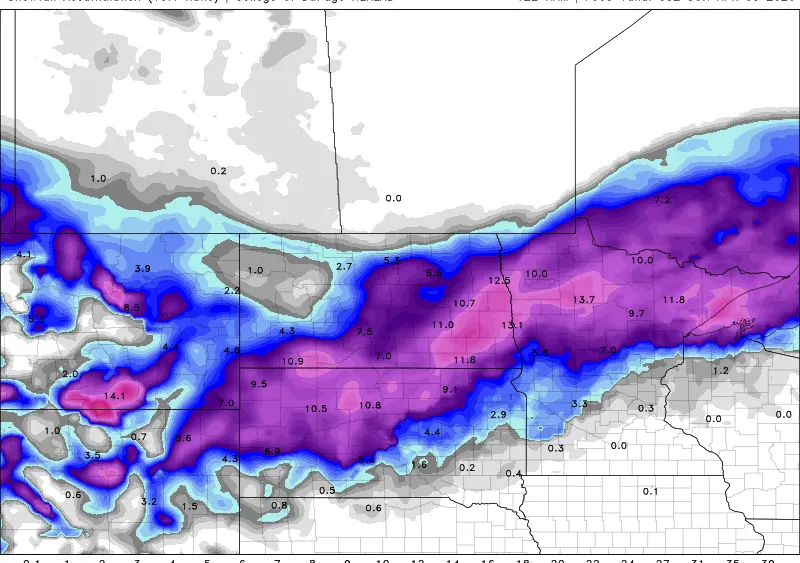
Latest snowfall maps from some wx models.
10:1 Snowfall 6z Euro through Sunday afternoon.

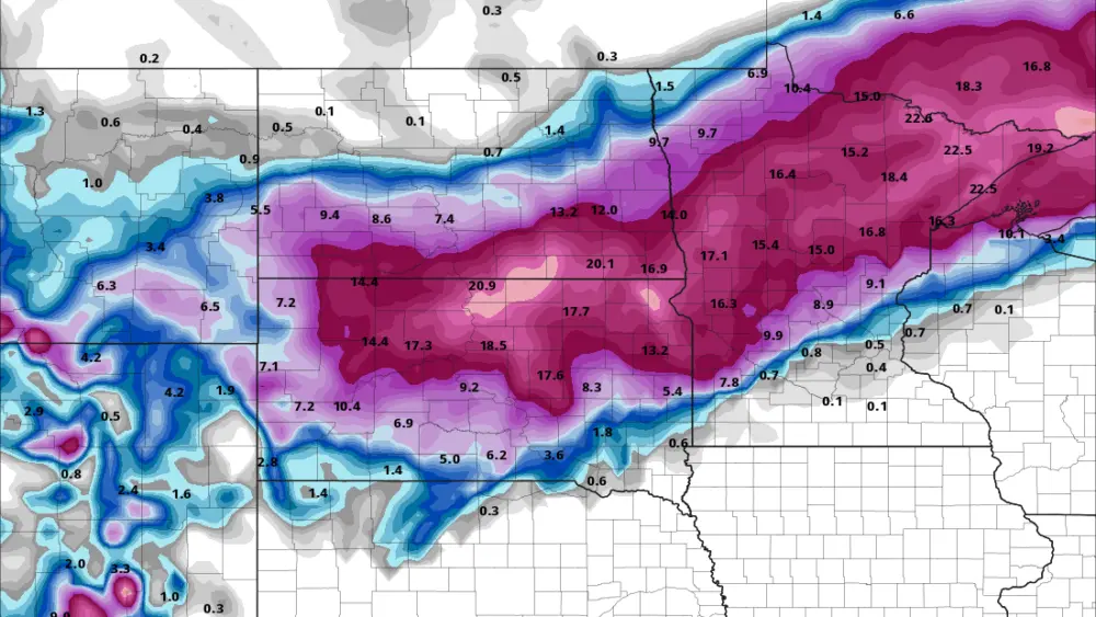
10:1 snow ratio 12z Hrrr through 6:00 Sunday morning

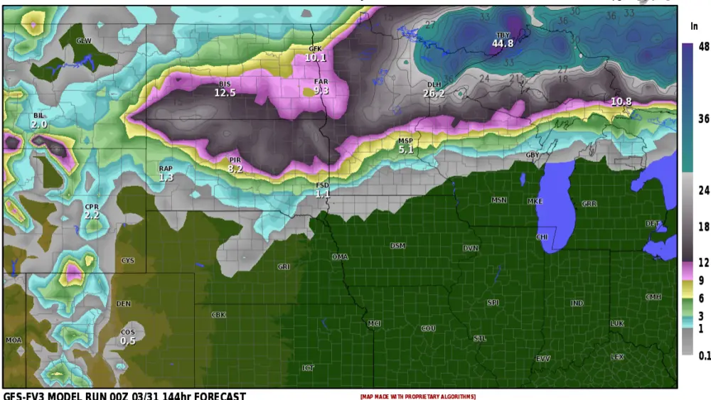
Total snow 12z Hrrr 6am sunday

total snow 15z Rap noon Sunday