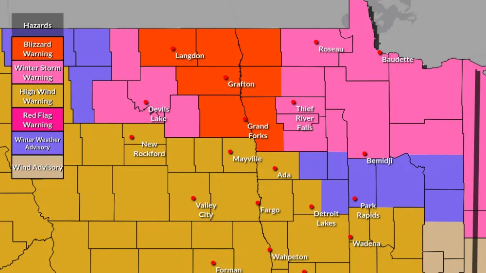
Widespread areas of dense fog is expected to develop late this evening into the overnight hours with areas of freezing mist and or drizzle. This will lead to large areas of significantly reduced visibility and scattered areas of slick roads from a light glaze of ice, or frost.
Even in spots where visibility is fine, it may drop very quickly when traveling.
Through the morning hours of today (Wednesday 1/24/24) light fog and areas of freezing mist created some slick areas of I-94 west of Fargo as well as I-29 north of Fargo to the Canadian Border with several vehicles reported in the ditch. I expect more of that in areas through the overnight and Thursday morning. I find it likely that Dense Fog Advisories will be issued tonight.
Some areas of dense fog and mist/freezing mist remain likely into the afternoon of Thursday with temperatures near the freezing mark of 32 degrees. More fog and freezing mist is possible through Thursday night into Friday morning.
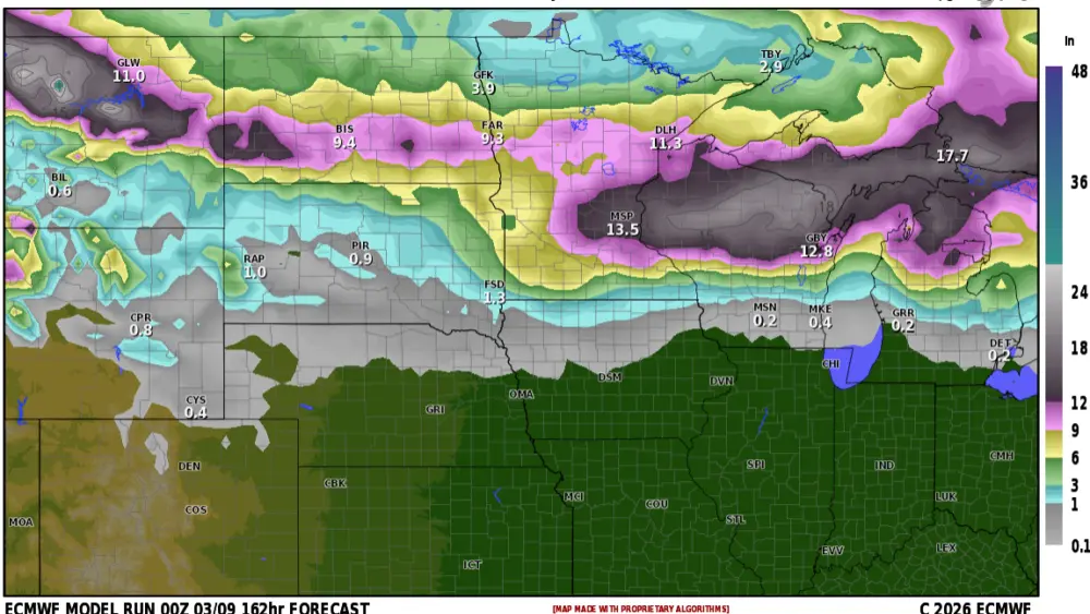
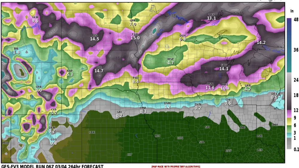
Here is a map of a possible light glaze of ice from freezing fog/mist and drizzle through Thursday night. I wouldn’t be surprised to see some light glaze into Central North Dakota that this model is not showing.

Now let’s talk more optimistically and look ahead into next week. Temperatures in the upper 30s to mid 40s are in the forecast! Could we see a 50-degree day? In areas of Western North Dakota and South Dakota, I think so. Although I do not find it likely I wouldn’t say that it is impossible, just unlikely here in Fargo.
Record highs for next week are in the 40s for Fargo. Record to near-record warmth is on the way!

Meteorologist,
Justin Storm