If you have been following along with our LRC seasonal calendar OUTLOOK for the winter. Then you would be familiar with our next likely chance to see a storm system up in our area would come over the 7th and 8th of February. In our past cycle of this years LRC would bring you back to the Christmas period ice storm. Now that being said I’m not saying that another major ice storm is going to happen.
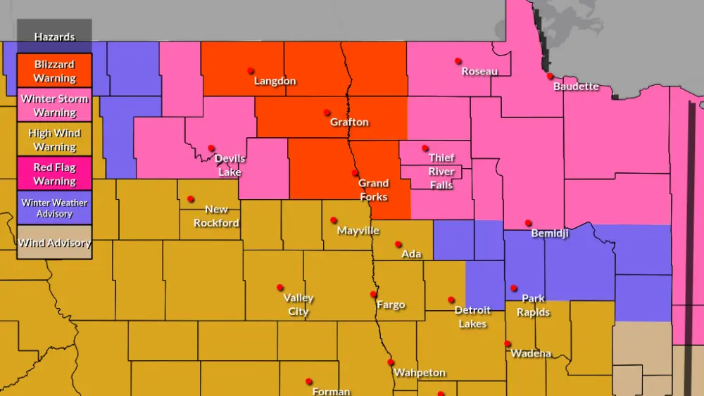
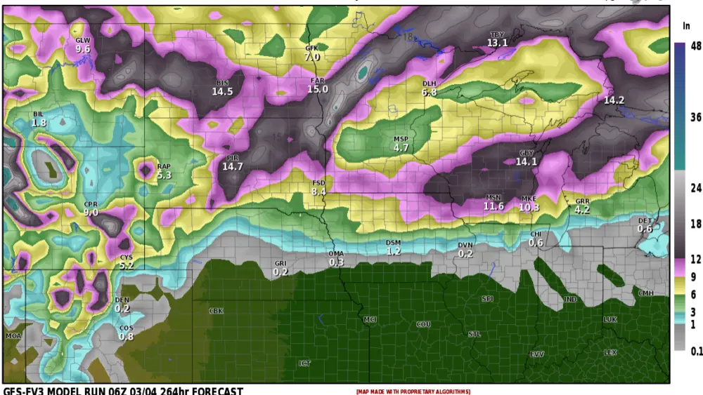
I will say it is likely to see another storm over that area, rain or snow probably both for some. We are still over a week away from this possible storm but models are now indicating a low tracking into the northern and or Central Clains. The latest GFS brings this in initially as a chance for rain turning over to snow on the 8th, Thursday morning, and snowing into Friday afternoon. See images one, two, and three.


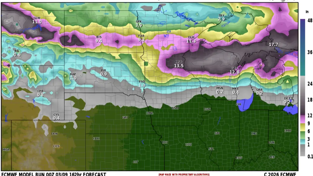
The European model also shows a low tracking up a bit further north into the Northern Plains but is a little less organized and drier. Images three, four, and five


Let’s give this a few more days and see how this evolves as it becomes more focused to get a better handle on track, whether it remains over us or if it shifts more southward. As well as possible impacts.
Meteorologists,
Justin Storm