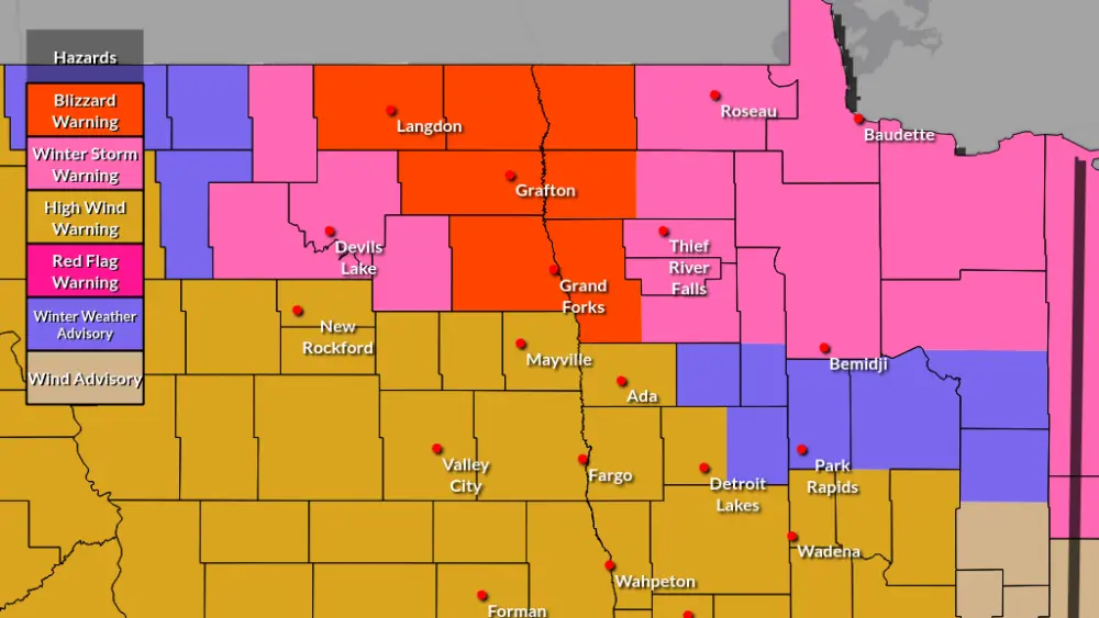
Another snow system will bring measurable snow to some Wednesday, mainly north of Highway 2. A Winter Weather Advisory goes into effect to the north from 6:00 am Wednesday until midnight for 3-5 inches of accumulation with areas of blowing and drifting snow and slippery travel.

There is an area of uncertainty circled above where I see the potential for a band of snow to develop through the morning hours, similar to what unfolded Tuesday morning to mid-afternoon. If said band is able to develop q quick inch of snow may be possible for some in that area. As a whole, that snow system is going to lift into the Northern Valley through the morning, stick around through the afternoon, and exit by the evening hours. Expect some slippery travel up in the far Northern Valley with blowing/drifting snow.
Down in the Central, Southern Valley, and areas of Minnesota Lakes Country will see a chance for a few rain showers in the afternoon as temperatures rise into the 40s and a few 50s from a SSE wind between 10-25+ mph. Wind will briefly kick up into the windy category gusting up to 40mph as winds turn more westerly by the mid-end of the afternoon but lighten up through the evening in the Southern Valley.
A general 1-4+ inches of snow is expected in the north, with isolated areas slightly higher. A possibility of areas of a dusting to an inch for the area circled above.
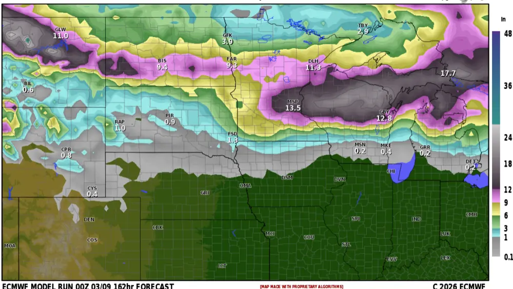
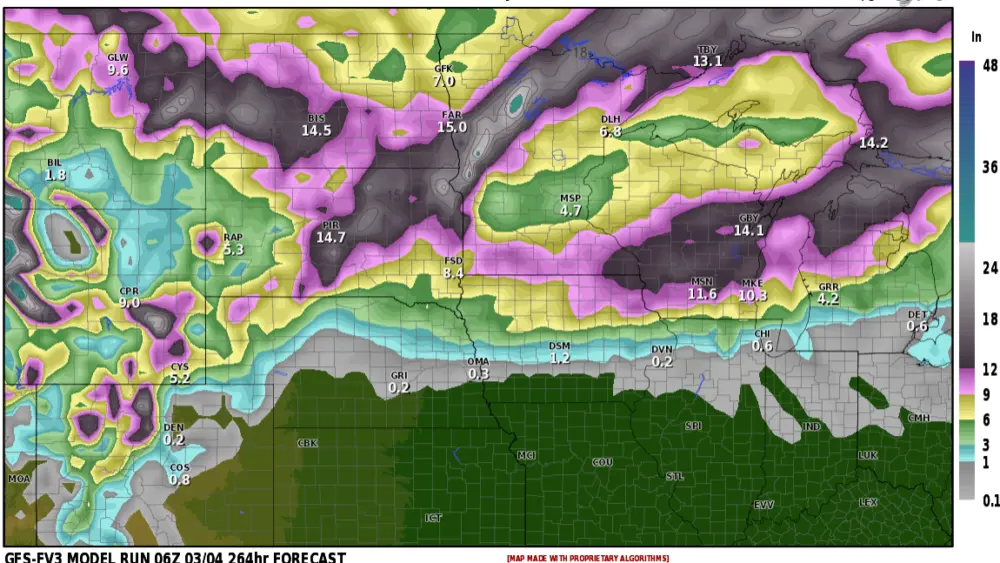
Here is an AVERAGE of models on expected snowfall, some spots may see amounts near these numbers, also some may experience less or more snow.

Meteorologist,
Justin Storm