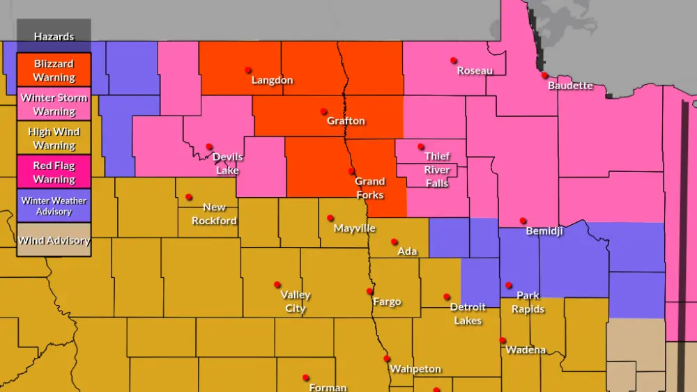
WINTER STORM WATCH is in effect for the F/M area. This does NOT include the far northern valley at this time. A major winter storm along with wind and heavy snow is likely to impact a large majority of ND and most of MN and SD. Current thinking is snow will start to overspread the area Sunday morning and pick up in intensity. Heavy snow and wind is LIKELY Sunday night into Monday. The storm will slowly depart by Tuesday morning but the winds will remain strong out of the NNW gusting up to 30+mph. The bullseye of the heaviest snow looks to be lined up just SSE of the F/M area.
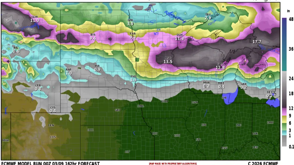
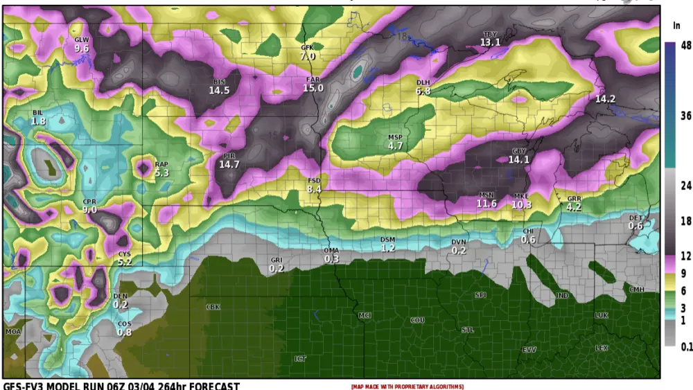
I’ve attached 5 different models and what they are predicting (click through the slide show) As you can see models are generally around 8 to 16″ of snow. While some areas WILL pick up 16+ inches, I am leaning toward 6-12″ of snow in the F/M area with locally higher amounts. Please keep up to date on the forecast if you have any travel plans this weekend. After this storm passes, there are 2 more waiting in the pipeline for Easter weekend into early April. I’m not saying both those storms will hit us but it’s something we are watching.
Chief Meteorologist,
Dean Wysocki