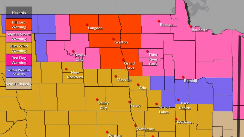
Not the storm of the century but it’s not done quite yet. Initial forecasts made by us looked like 6-12″ of snow for the F/M area with higher amounts in Lakes country. So far, here’s what we’ve received…

https://www.weather.gov/source/crh/snowmap.html?sid=fgf
Now, with the main storm still to our south and moving north, the “deformation zone” is currently setting up and the models are doing a HORRIBLE job in it’s placement. The deformation zone will dictate any additional snowfall totals which appears to be about 1-3″ of additional snow over the area with higher amounts into lakes country.

Although not a LOT of additional snow expected (exception in lakes country) the wind will be gusting around 40mph causing quite a bit of blowing/drifting of the snow afternoon into evening. Bottom line, don’t let your guard down just yet, the storm isn’t quite over.
Chief Meteorologist,
Dean Wysocki