It’s getting close to planting season and it’s been very dry the last 30 to 45 days so now it’s getting close to “crunch time”. We need the moisture in a bad way, or we may be looking at drought conditions for spring/summer. We use the LRC model to forecast long term and although it’s not 100% (no model is) it has been proven to be more accurate 30 days out than many 7 day forecasts you find on your app. So, with little precip expected in the F/M area over the next 10 days or so, I decided to pull up the LRC model and take a look at what mid April through mid May looks like in regards to precip.
The main chart depicts ND and MN and from mid April to mid May looks like we will see beneficial moisture for the Eastern 1/3rd of ND and into MN. However, dry conditions look to maintain itself for central and western ND. This is NOT good news for the drought conditions out to the west of the valley.
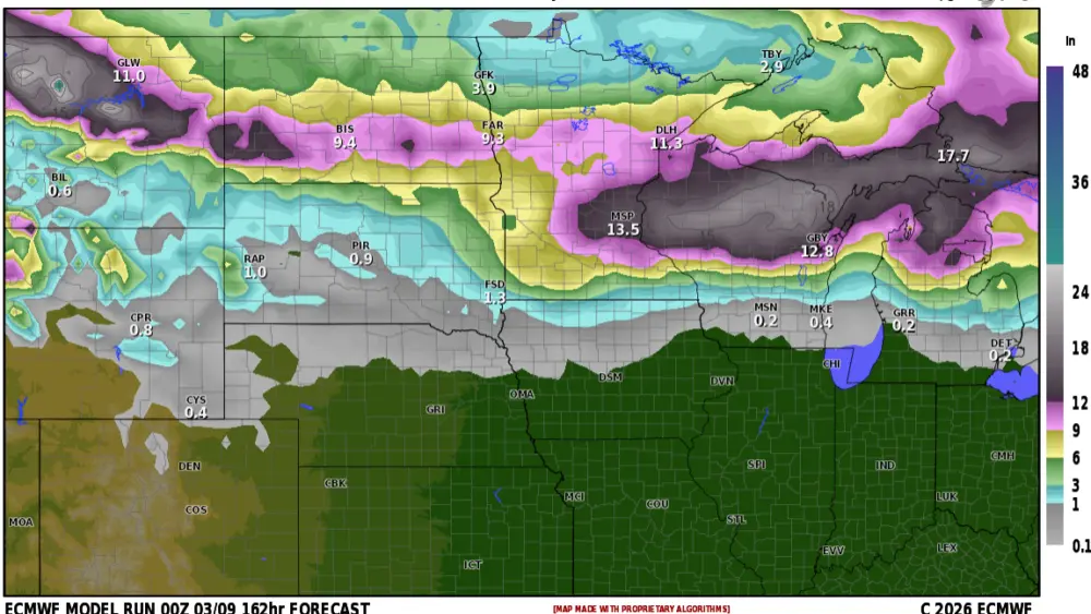
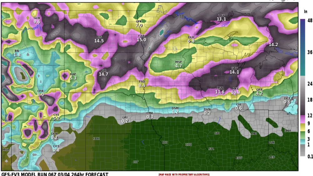
Now let’s take a closer look at WHEN the main precip is expected to occur in the VALLEY and into Lakes country.

Note, there are a couple of “spikes” in precip (above 100%) those would be our BEST chance of appreciable rain. According to the LRC, April 20-23 and then again May 6-10th. Look at the above average precip expected in early MAY….250 to 400% above normal. So that May storm has the potential of HEAVY RAIN. We need the moisture but hopefully not all in one round.
Chief Meteorologist,
deanwysocki