Watch for convective snow showers to build through this morning into the afternoon across the area. What is a convective snow shower? Well, think of summer when we get thunderstorms. You can see the clouds building and bubbling up until they hit a certain height referred to as the equilibrium layer where they then “anvil out”. That will happen today and since it will be cold enough it will be snow vs rain. Now not to any extent in regards to the height and strength of a typical thunderstorm that can rise to heights of 30-50+ thousand feet. We are talking more in terms of a couple to a few thousand feet, and not even comparable to available energy. However, like thunderstorms that can produce downpours, some of these snow showers can produce impressive snowfall rates over a short period. Meaning that even though these snow showers will be scattered and small, there will likely be some that can produce moderate to heavy snowfall at times. Mix this all with wind between 15-30+ mph you will come across some areas that have some briefly drastically reduced visibility to a half mile or less around the area. Along with the possibility of some minor snow accumulation on mainly grassy surfaces. Snow that does stick will be short-lived and by tomorrow it should all be gone as temperatures rise to highs in the 40s and lower 50s with sunny skies!
In short, watch for scattered snow showers today, mixing with some rain at times, and some areas of reduced visibility from falling snow due to a WNW wind of 15-30 mph.
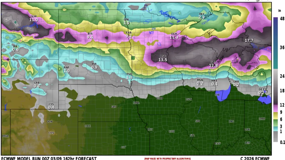
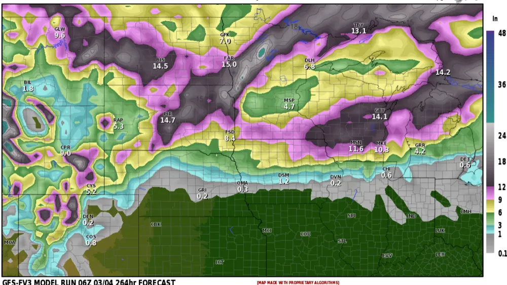
In the above picture, you can see model indications of flurries/light snow in light blue, and convective snow showers in the darker blue for this afternoon.
Meteorologist,
justinstorm