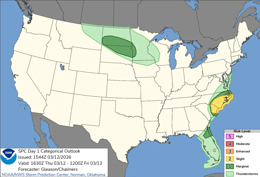
What an unbelievable dynamic storm with blizzard conditions in the N. Valley to possible thunderstorms in the S. Valley with damaging winds possible.
Not often to you see blizzard warnings along with the possibility of severe wind gusts in the same storm. The SPC (Storm Prediction Center) has highlighted areas SW of Fargo for a possible severe wind risk with thunderstorms, while the N. Valley is under a Blizzard Warning:
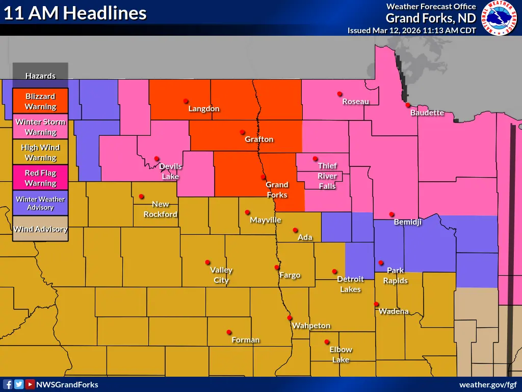
Snow will overspread the Valley around 2pm then change to rain in the Central and Southern Valley…..snow will continue throughout the N. Valley into N. Minnesota where conditions will deteriorate throughout the afternoon and especially into the evening. The worst part of this storm will grip the area from 3pm through midnight. Travel is NOT recommended north of Hwy. 200. as we head into late afternoon/evening.
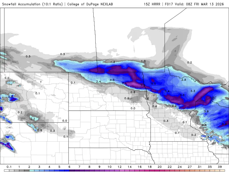
Snowfall amounts will range from 3-6″ in the north to 1/2″ to 1″ possible in the F/M area:
Conditions will slowly improve Friday morning as winds relax after sunrise.