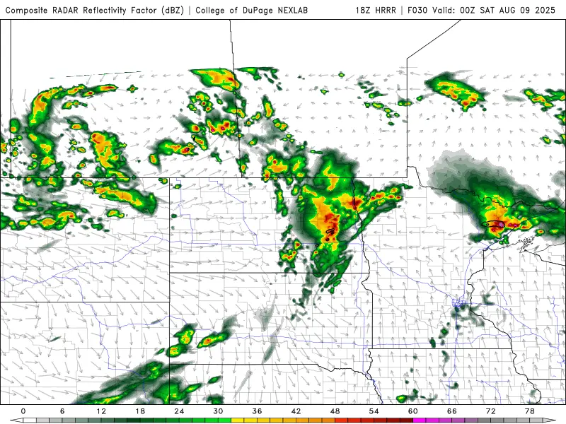
Back in March, the LRC predicted a “stormy” period around WEFest. It’s unfolding about as predicted with severe storms possible tonight and Friday. Here’s a look at simulated radar around 2am:
Notice that “bow” in the line of storms approaching Grand Forks. That would indicate damaging winds as it pushes though.
After that line of severe storms passes through into NW Minnesota, we will see general storms behind that line.
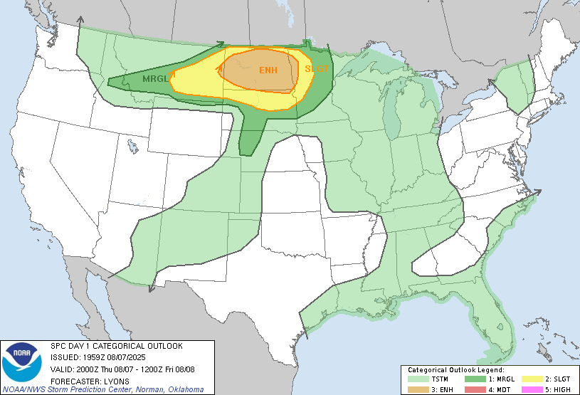
Then our attention turns to Friday. Here’s what the SPC (storm prediction center) is thinking in regards to severe weather:
There is a slight risk for severe weather over eastern ND and NW Minnesota. Main threat with this round of severe weather would be large hail. It’s not a guarantee, however. Alot will revolve around IF we see enough sun emerge on Friday to really destabilize the atmosphere. IF and it’s a big IF that happens, large hail would be approaching the Valley late afternoon into early evening. If we DON’T see enough sunshine the storms most likely would remain below severe limits…..stay tuned.
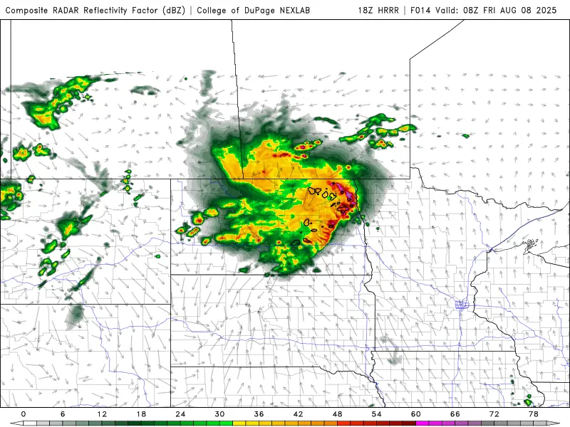
Here is a look at what one of our short term models is predicting Friday around 7pm:
Storms approaching from the west will pack a punch but severity of the storms depends on if we get enough sun to really destabilize the atmosphere.
We have been experiencing some flooding across the area so more rain is not what we need. Here’s a look at where the heaviest rain is expected to fall:
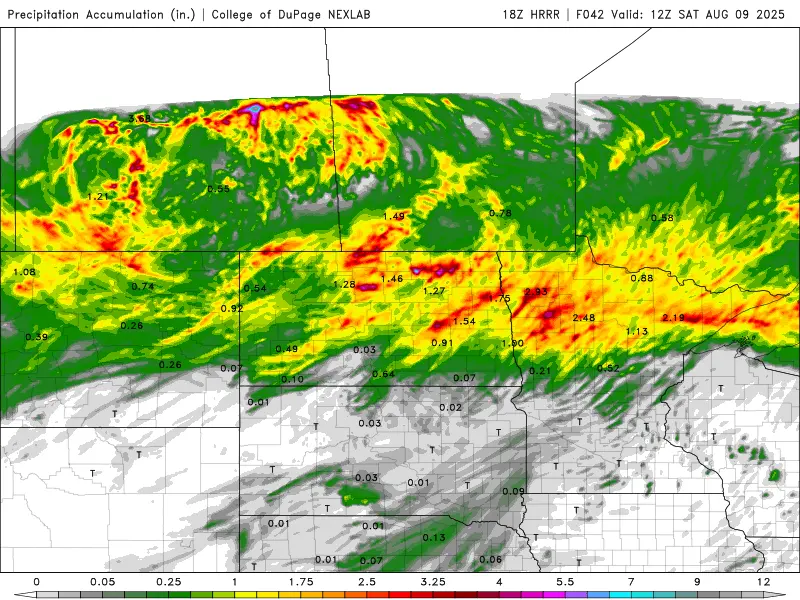
A general 1-2″ band of rain across much of the area but I do believe there will be pockets of 2-4″ along the Hwy 2 corridor.