Enjoy this week as we will continue to see temps WELL above normal and close to record warmth on Thursday!! We’ve been pretty spoiled this winter with snowfall totals remaining well below normal. We are over a foot below normal so far this season, however, we may erase that deficit later next week.
Here’s how it’s shaping up. After a mild week of 30s and 40s this week into early next week, we will undergo a pattern change with a few “Colorado lows” coming out of the Rockies and pushing into the northern plains. When forecasting this far out, we look for consistency in our models. Typically, accuracy in the models more than 5 days out is 50% at best. However, the LRC which has proven 80% accurate MONTHS in advance, does have Feb. 18th-24th highlighted for heavy snowfall.
Now, speaking of consistency. 2 of the main models we use are the GFS (American model) and the ECMWF (European model) Typically the European model is the more accurate model. With that being said, lets take a look at yesterday’s GFS and ECMWF and compare them to todays when we are looking at snowfall amounts for the 18-24th. Again, what we are looking for is consistency!!
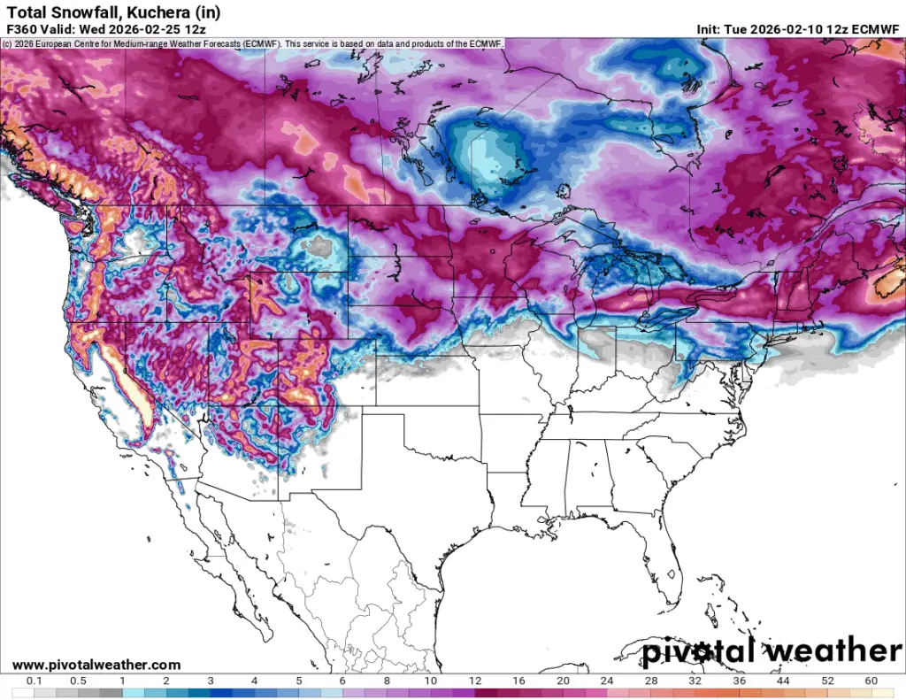
Here’s the GFS from Today vs. yesterday
GFS today
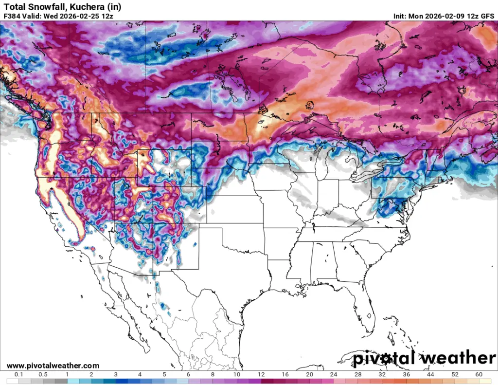
Look at yesterday’s model run ^^ vs todays model run. 30+” vs around 6″ Obviously 30+” isn’t realistic but the flip flop in the model runs makes you question it’s validity.
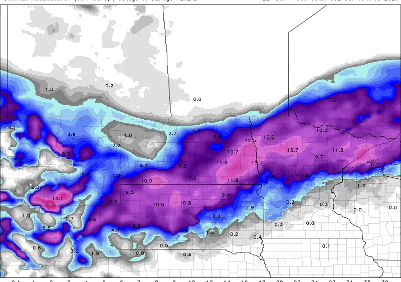
Now, lets take a look at the ECMWF:

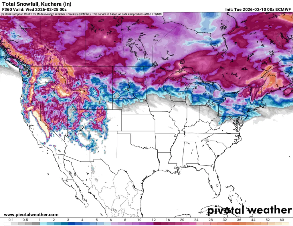
There’s a lot more consistency in snowfall totals for the F/M area. Consistency is key and if the European is to be believed, 12+” is possible over the area over that 7 day span.
Again, some things will change between now and then but rest assured, more snow is on the way later next week into the following week so don’t let this weeks mild weather fool you. Stay tuned….