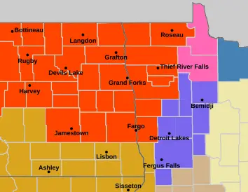
Anytime the “B” word is thrown around, it usually means impossible travel conditions. Will that be the case for Thursday?? It sure looks like it across SOME of the area! A strong area of low pressure will be moving out of Canada and into the N. Plains. The map below indicates the center of low pressure in N. Minnesota:
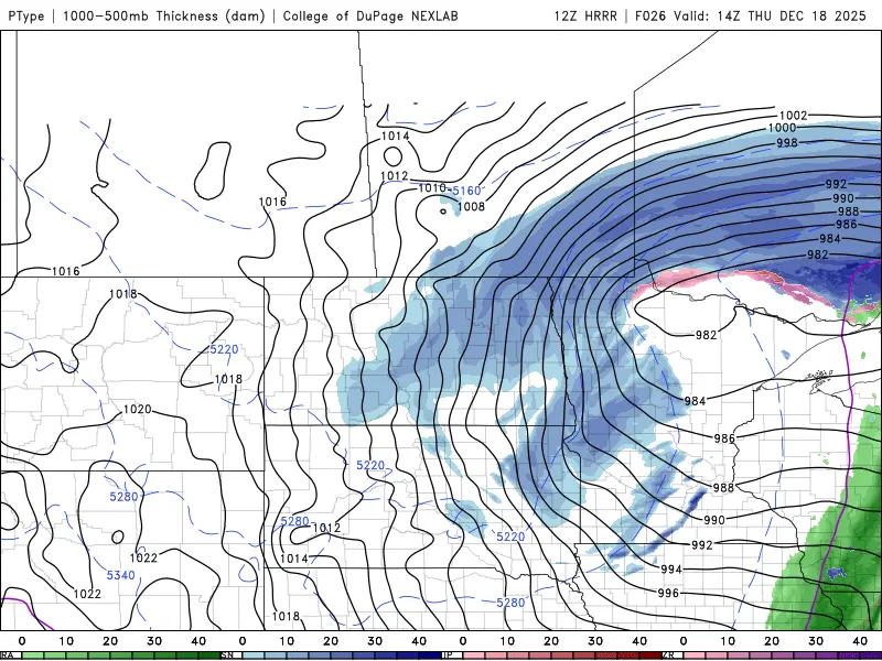
The closer those “black lines” isobars are together, the windier the conditions will be. VERY WINDY conditions expected along with falling snow tomorrow between 7am and 2pm. Many areas, especially N. Valley into N. Minnesota WILL have blizzard conditions. While I’m not expecting a lot of snow, only 1-3″ across the area, it only takes an inch or so along with 50mph winds to create blizzard conditions. Here’s a look at some of the snowfall predictions from our models:
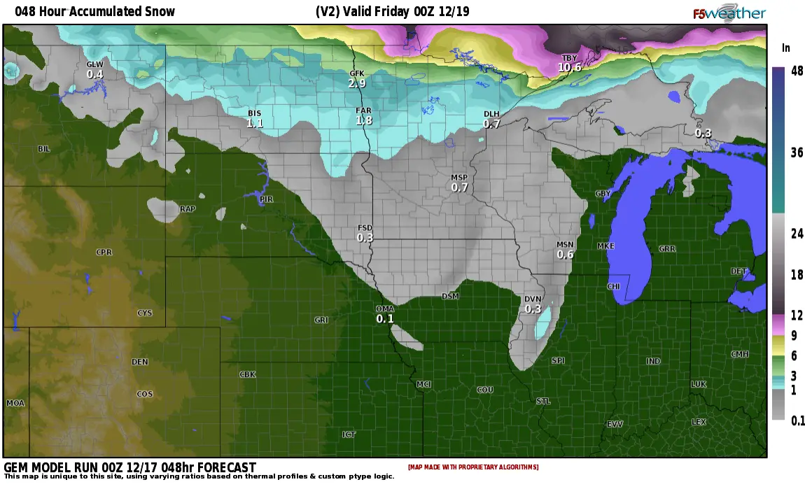
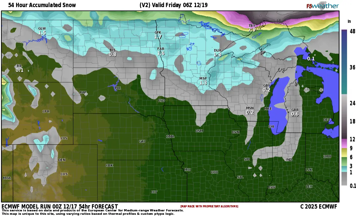
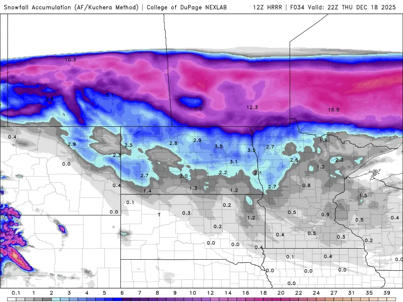
As you can see, not a ton of snow, unless you are in southern Canada…..ufffdaaa!!!