Many parameters are coming together for severe weather Friday night after midnight. Now while this is NOT a guarantee, many ingredients will be in place for a round of severe weather. Here is a look at simulated radar at midnight:
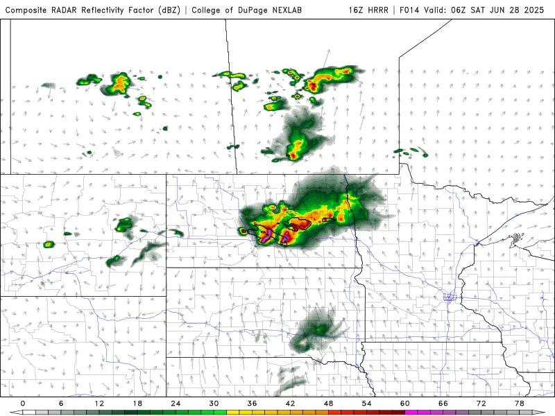
Here’s a snapshot at 2am:
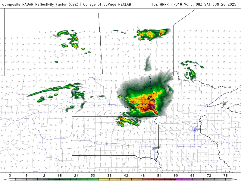
And at 3am:
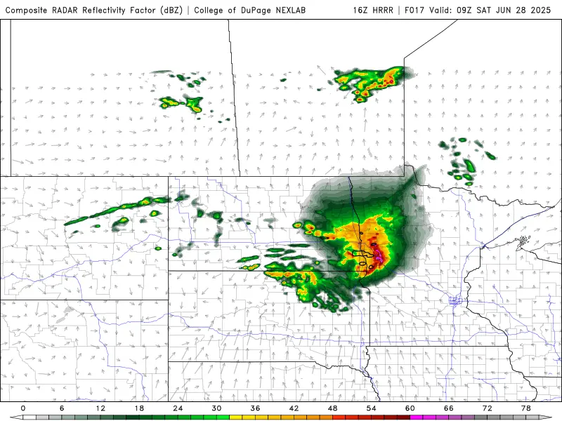
Notice the “bow” shape as these storms move into Lakes country. This indicates very strong winds 70+ mph. The main threat with these storms tonight will be hail and damaging straightline winds. Be weather aware after midnight as some areas WILL get severe weather.