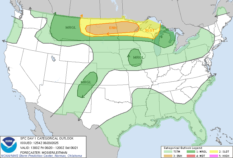
As an area of low pressure cranks up to our SW over the next few days, a warm front will be lifting north later today. A very unstable airmass will develop along the warm front which will be aligning along the 94 corridor. Winds will be “turning” with height which causes spin in the atmosphere and often leads to severe storms. Here is the latest look at what SPC is thinking for severe weather. Here’s the tornado threat:
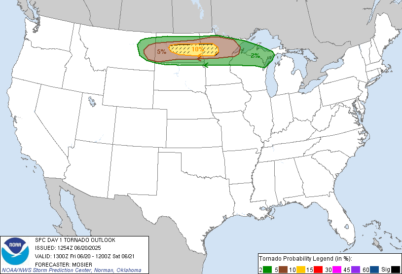
This means there is at least a 10% chance for an EF2 or higher tornado within 25 miles of the hatched area . Here’s a look at hail and wind threat:
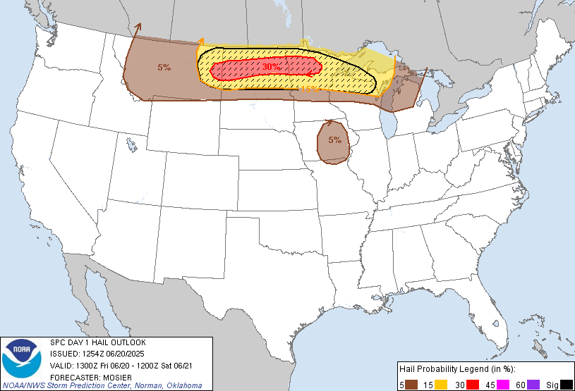
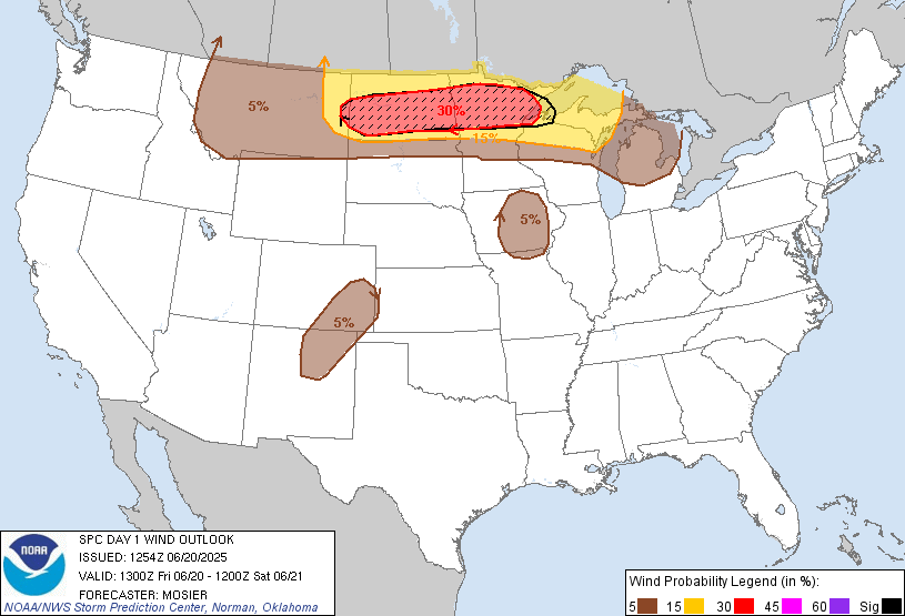
There is a slightly wider risk of severe winds of 70-80mph within 25 miles of the hatched area. Be weather aware after 9pm tonight for rapidly changing conditions.
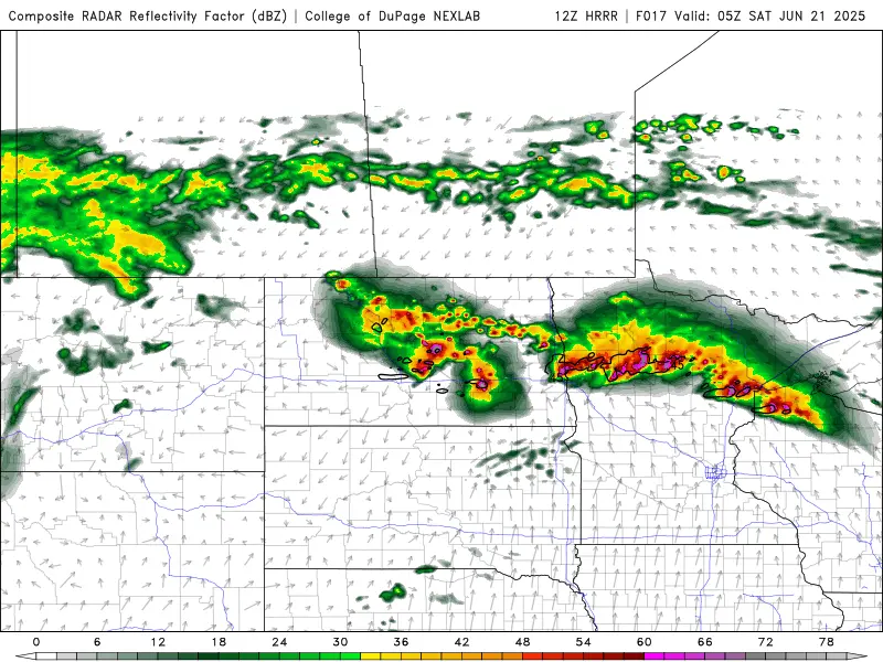
This is a “simulated” look at what the radar is expected to look like around midnight. 94 corridor and northward look to be in the crosshairs. These storms will quickly race ENE
A HOT and humid Saturday is expected with temps in the 90s. A cold front will bring some relief on Sunday west of the valley but from the Valley eastward, it still looks sticky. Cooler 70s return for Monday and Tuesday. If you receive any severe weather please email them to weather@flagfamily.com.