The stormy part of the LRC cycle is about to happen. What does that mean? Well, the LRC cycle this year is approx 41 days. So, lets rewind 41 days back into May. During the “stormy” part of the LRC cycle in May, we had heat (90s) and we picked up about 2.42″ of rain during that period.
Now, lets see what cycle 7 of the LRC holds for Mid June through the end of June. ALL of our models are projecting some widespread rainfall over the next 10 days:
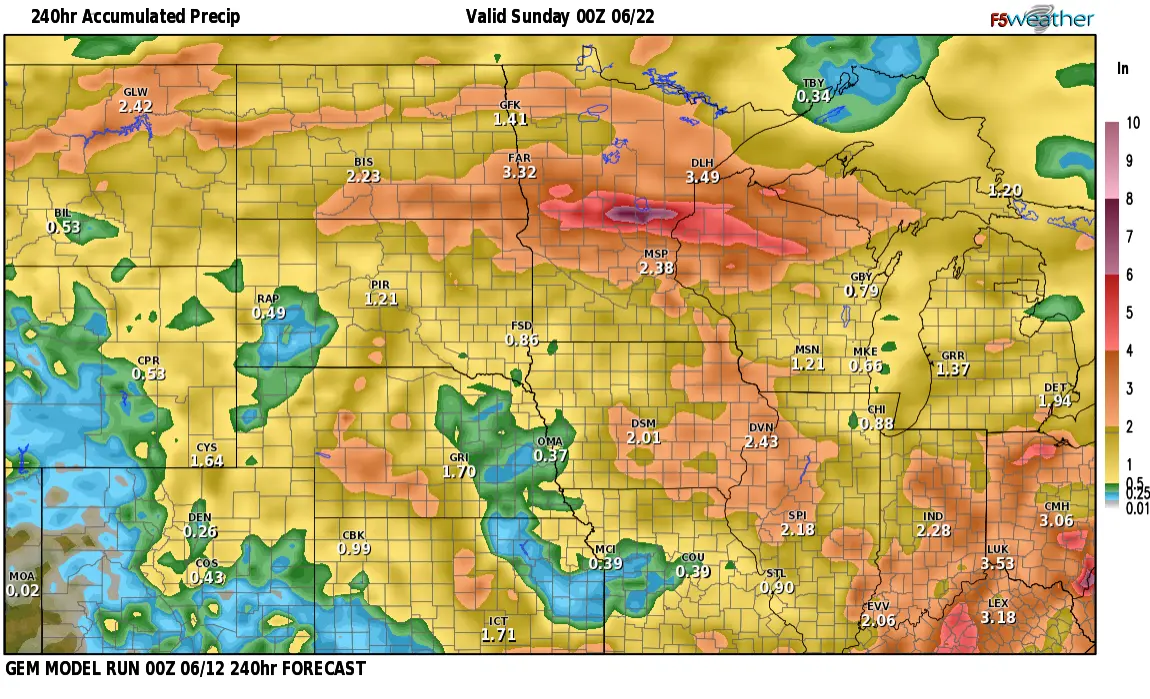
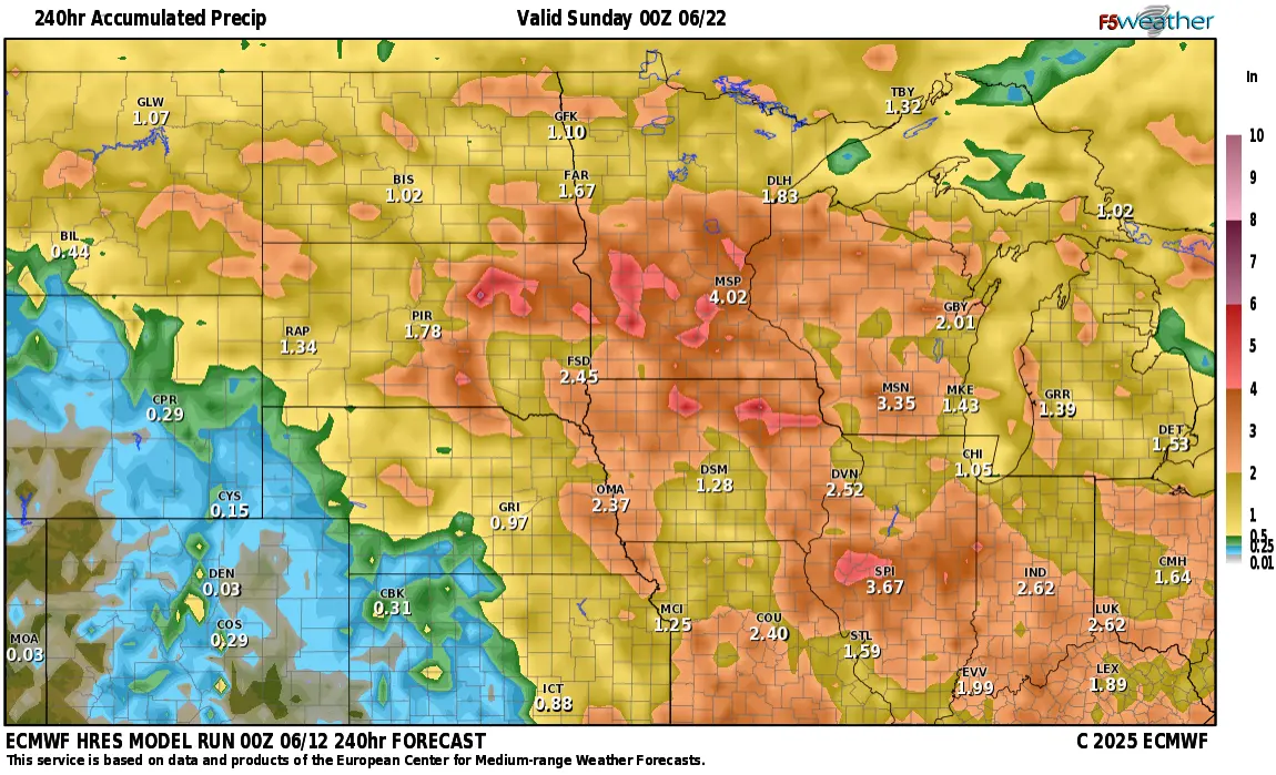
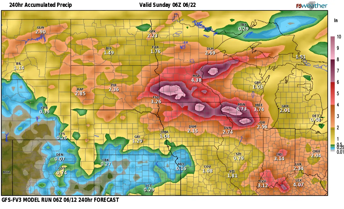
Most of ND/SD/MN are all on the cusp of a heat ridge. What is a heat ridge? It’s basically an area of high pressure to our south. Heat builds underneath the area of high pressure during the summer and spreads northward. Typically, you will see numerous thunderstorm complexes ride along the top (northern end) of the heat ridge. There is expected to be some pretty impressive, almost excessive, rainfall amounts into SD and MN. over the next 10 days.
This is a look at 3 different models over the next 10 days and it paints out a pretty wet picture for the northern plains. Typically models over forecast rain amounts but the trend of the heaviest is lining up from SD into MN. This same pattern will cycle back end of July into early August.