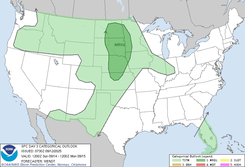
Summer isn’t over just yet!! We have a warm and humid weekend ahead with temps in the mid to upper 80s!!! Record highs are in the 90s for this weekend so that isn’t in jeopardy. After this weekend, we start to go into the “stormy” part of the LRC cycle for about the next week or so. As we head into the latter part of the weekend, there are storms expected in the F/M area Sunday late into Sunday night and some of those could be on the strong/severe side. Right now, SPC (Storm Prediction Center) has put our area in a “marginal” risk for severe storms but i’m expecting parts of the area to be upgraded to slight risk:
Much of the state could pick up some decent rainfall through next Thursday. Here’s a look at a few of the models precip outlook through next Thursday:
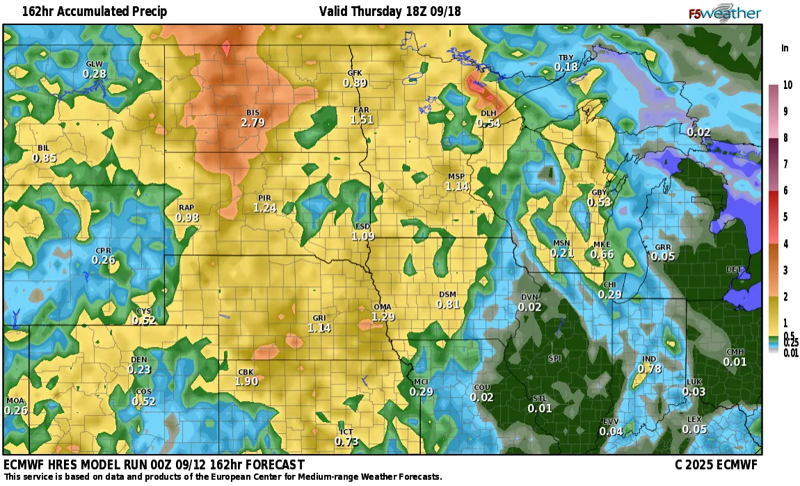
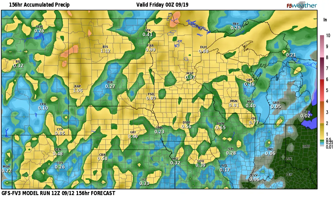
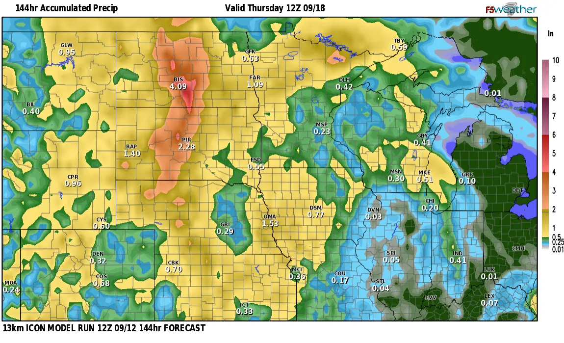
As you can see…a wide variance in totals but the main theme is widespread rain with the heaviest likely to fall in the central and western part of the state.