
We saw a quick moving system move through the area EARLY this morning and it did deposit SOME rain across parts of the area:
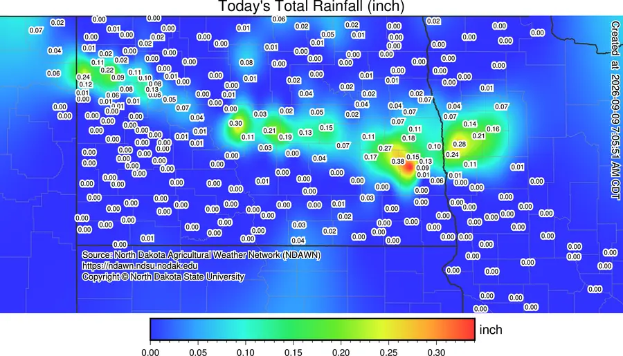
Officially, the airport picked up .02″ while parts of NW Fargo picked up .30″ Another hit or miss scenario!! After a breezy and cooler day today, summer heat builds back in for the end of the week with highs in the mid to upper 80s with breezy south winds.
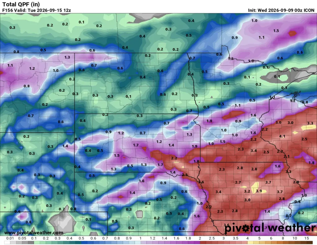
Afterwards, our attention focuses on the weekend. Cooler air from Canada will pour into the area with 60s and 70s for highs. The good news, for most, is that some much needed precip will be pushing into the area. Currently, our models are ALL over the place with WHERE the heaviest rainfall will align. Take a look at precip forecasts through Tuesday morning:
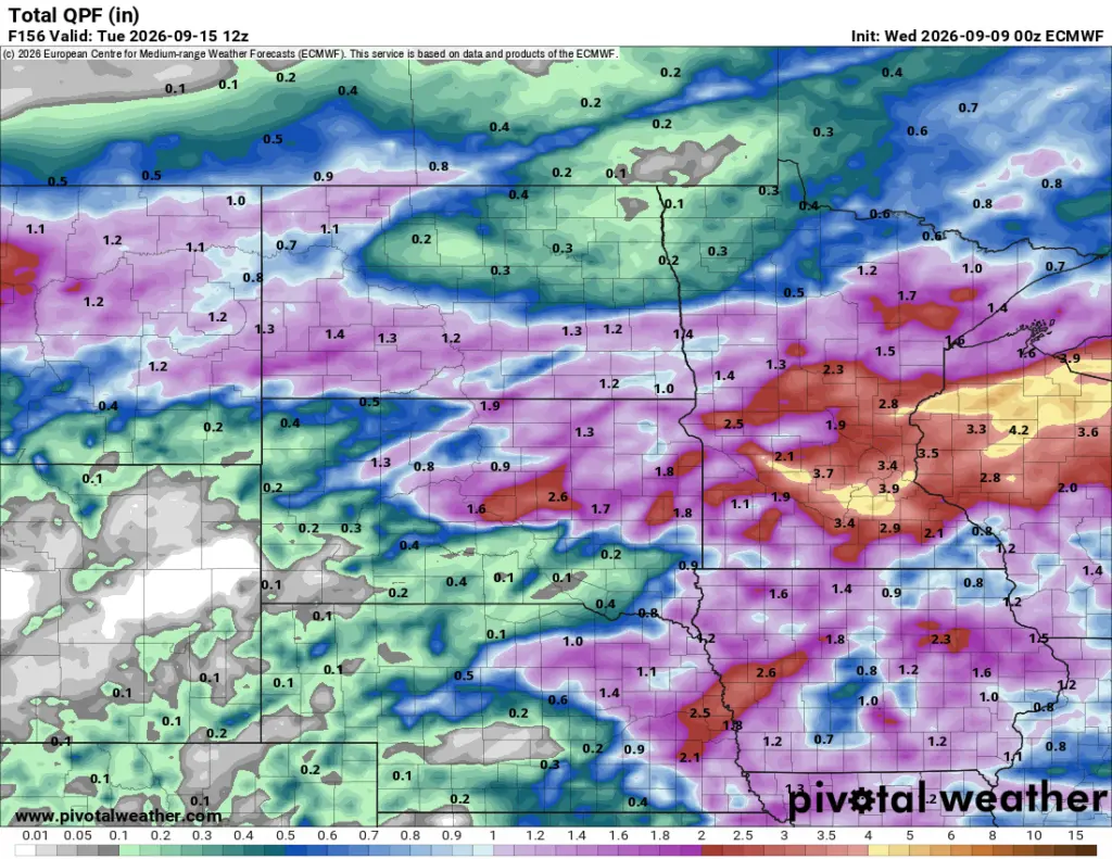
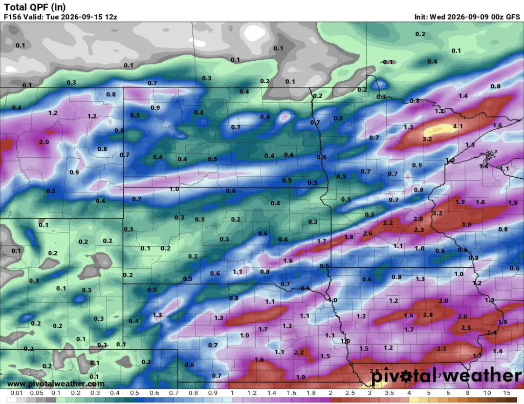
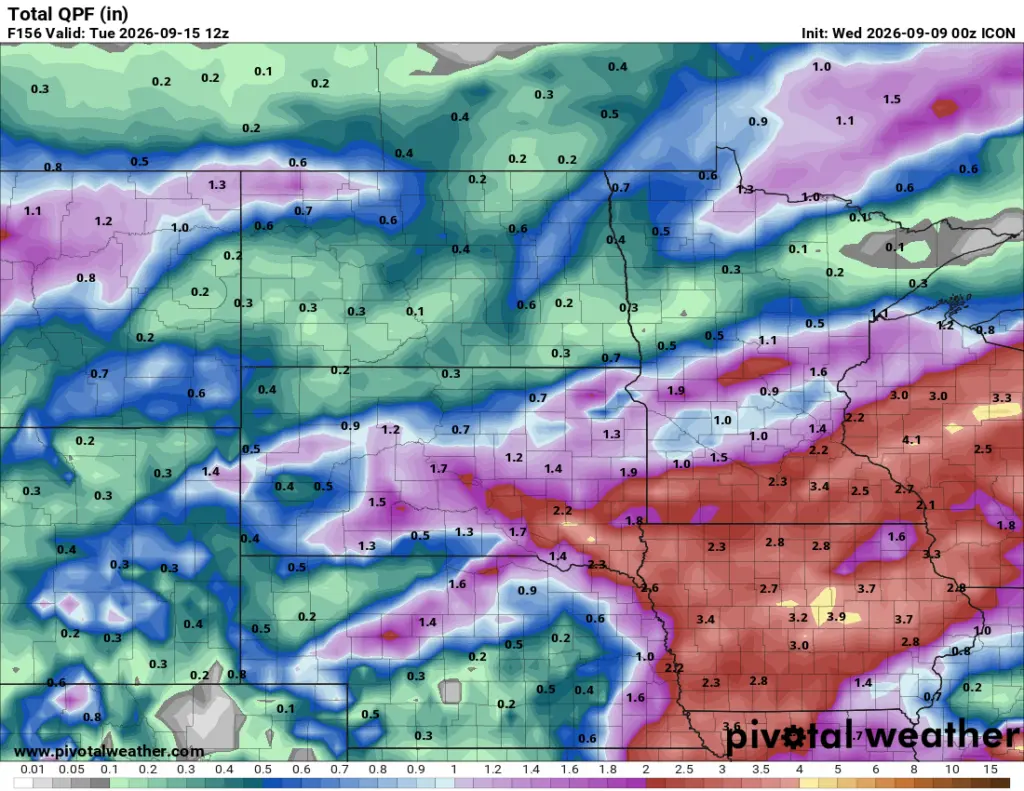
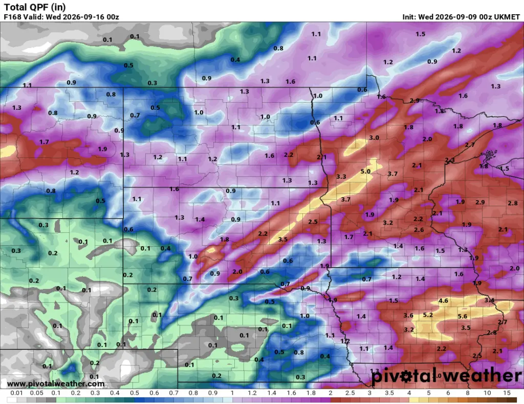
One thing for sure is we will get some rainfall Sunday afternoon through Monday. Some areas will pick up to 1″ of rain with locally higher amounts possible. We will fine tune where the heaviest rain will fall but from this standpoint it appears along and south of 94 corridor…..stay tuned.