A WILD weather pattern for the next few days with a winter feel in the N. Valley and spring temps in the S. Valley. Here’s a look at lunchtime temps today:
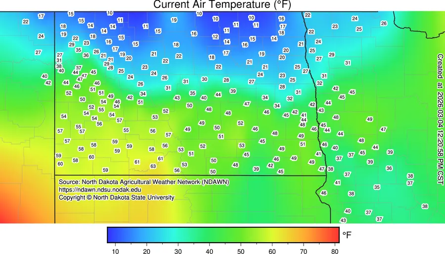
Dense fog and 20s in the N. Valley while temps in the 40s approaching 50 in the S. Valley. That is due to a front bisecting the area with much warmer air south of the front. That front will move southward tonight producing more fog then move back northward on Thursday producing similar temps to today with 20s north and near 50 south.
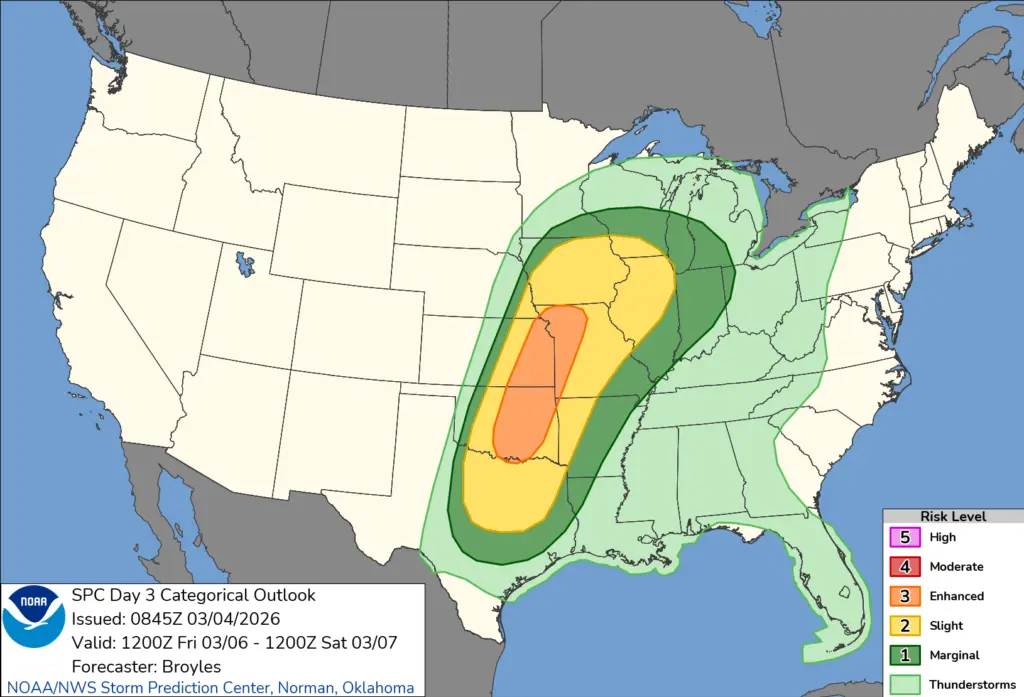
Afterwards, a pretty strong storm will ride to the south of the F/M area on Friday producing a possible severe weather outbreak in the central plains:
In our area we will likely see a wintry mix on Friday changing to a little light snow. Accumulations will be less than 1″ the way it currently appears.
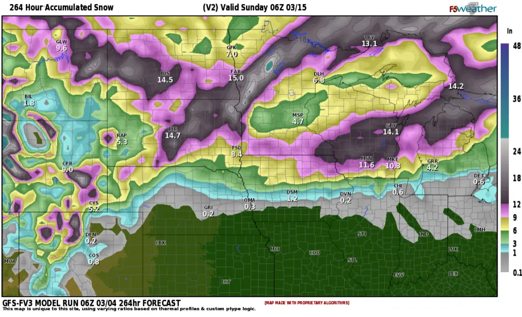
Temps will warm right back up over the weekend into the 40s to near 50 or so on Sunday….BUT….a more active weather pattern sets up next week with more SNOW. After all, it IS still March. 3 storm systems on the horizon for next week with more snow:
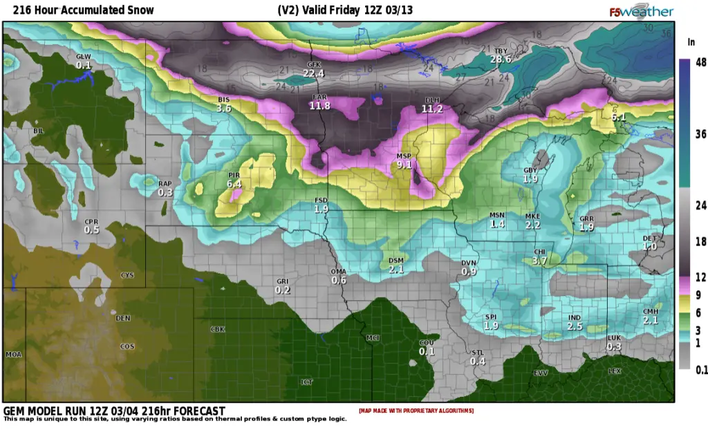
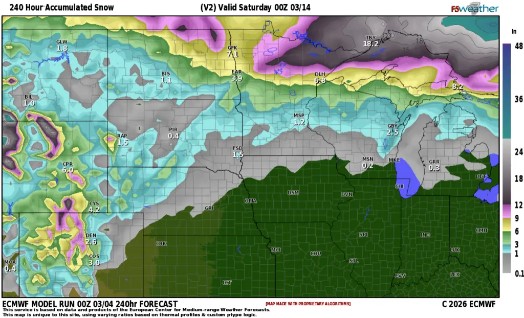
This is a couple of our long range model outlooks for snowfall through next weekend…..don’t put away the snow shovels just yet. Afterall, it IS still March.